by Keith Wiley | Feb 12, 2017 | Adventure
an ancient mayan miracle
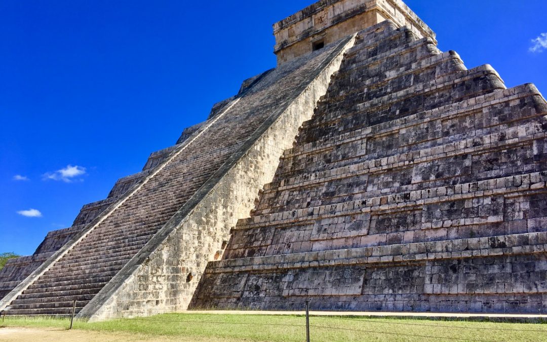
Remember when the world was supposed to end on December 21, 2012? That prediction was derived from the ancient Mayan calendar, which was so advanced that it could predict that every 5,126 years all of the planets would be in perfect alignment. How could an ancient people have such incredible knowledge of astronomy and math? This question has been haunting me ever since my recent visit to the Chichen Itza pyramid, in Yucatán, Mexico.
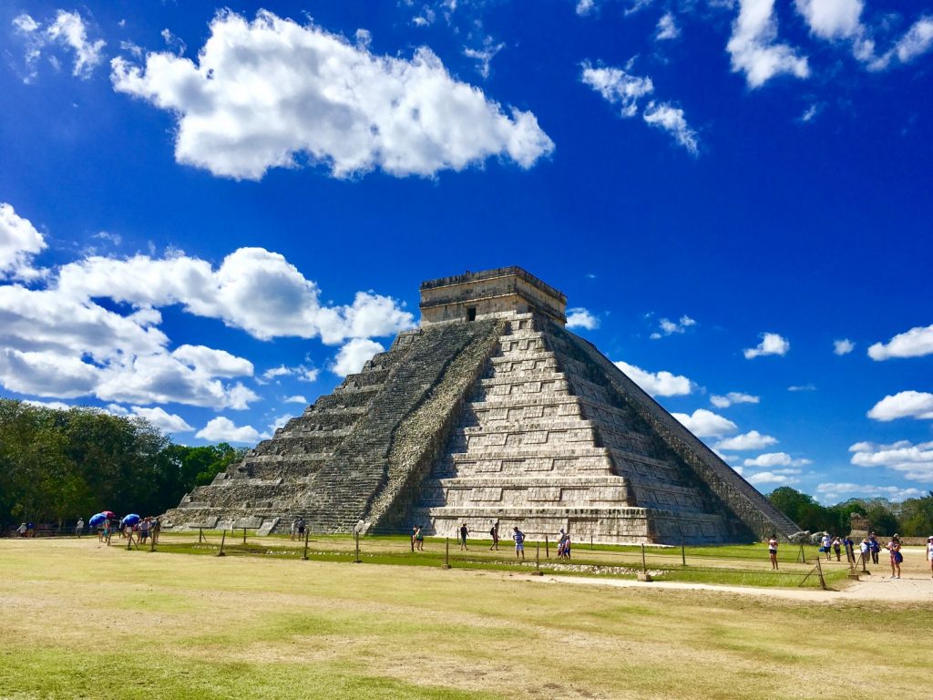
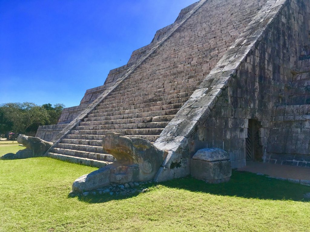
chichen itza pyramid known as el castillo or kukulkan
It’s incredible that over 1000 years ago, the Mayans could predict rare astronomical events such as solar eclipses and equinoxes. They didn’t even have telescopes back then as far as we know. They appear to have learned all of this by studying how the sun, moon and stars traveled across the sky and how shadows on the ground changed over time. Imagine how connected to nature the Mayans had to be to learn these things on their own. We admire the Mayan connection to nature and rely on nature’s gifts on a daily basis to maintain our own personal health.
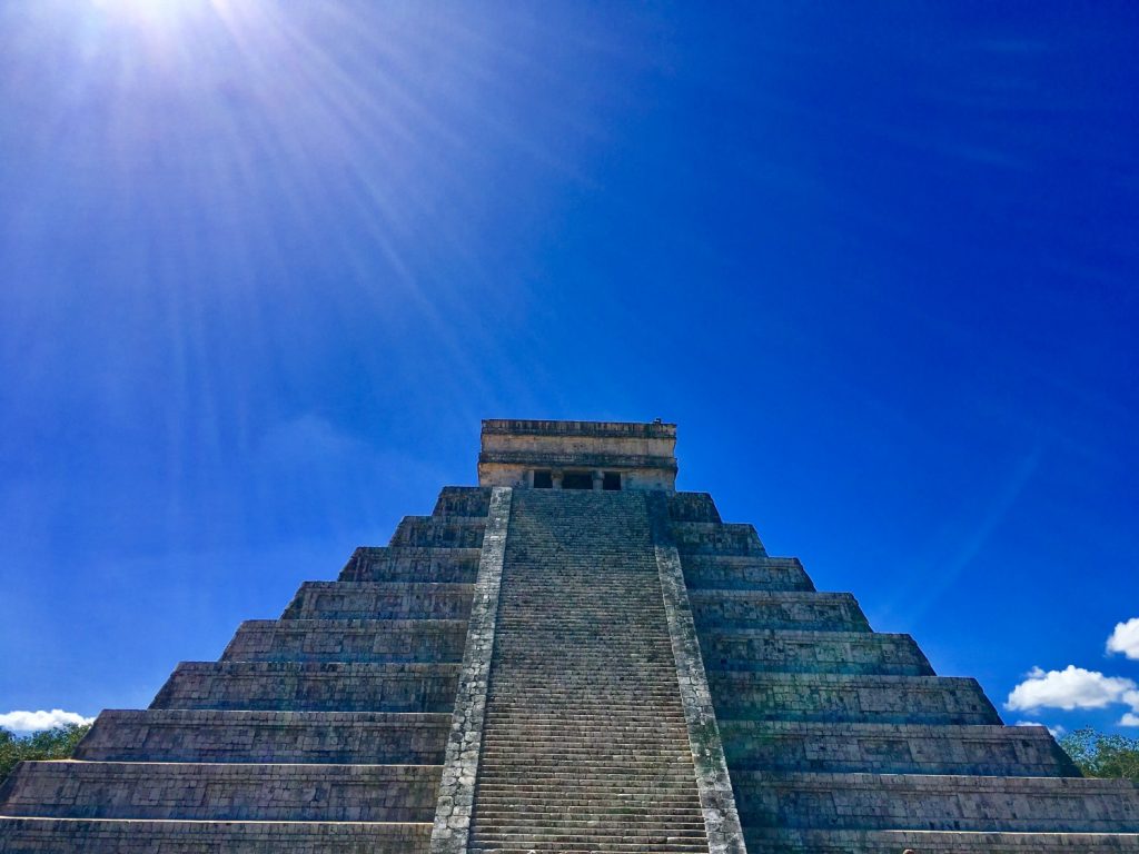
chichen itza pyramid
the ingenious mayan calendar
They built incredible observatories to study and create the Mayan calendar. That calendar would help them to know when to plant, when to expect the rainy season, and when to harvest. The Spring equinox marked the planting and rainy season. The Autumnal equinox marked the time to harvest.
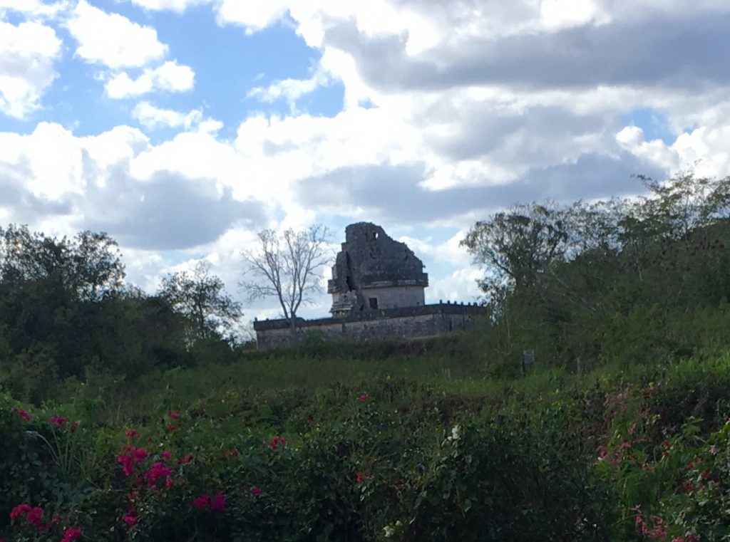
an ancient observatory at chichen itza called el caracol
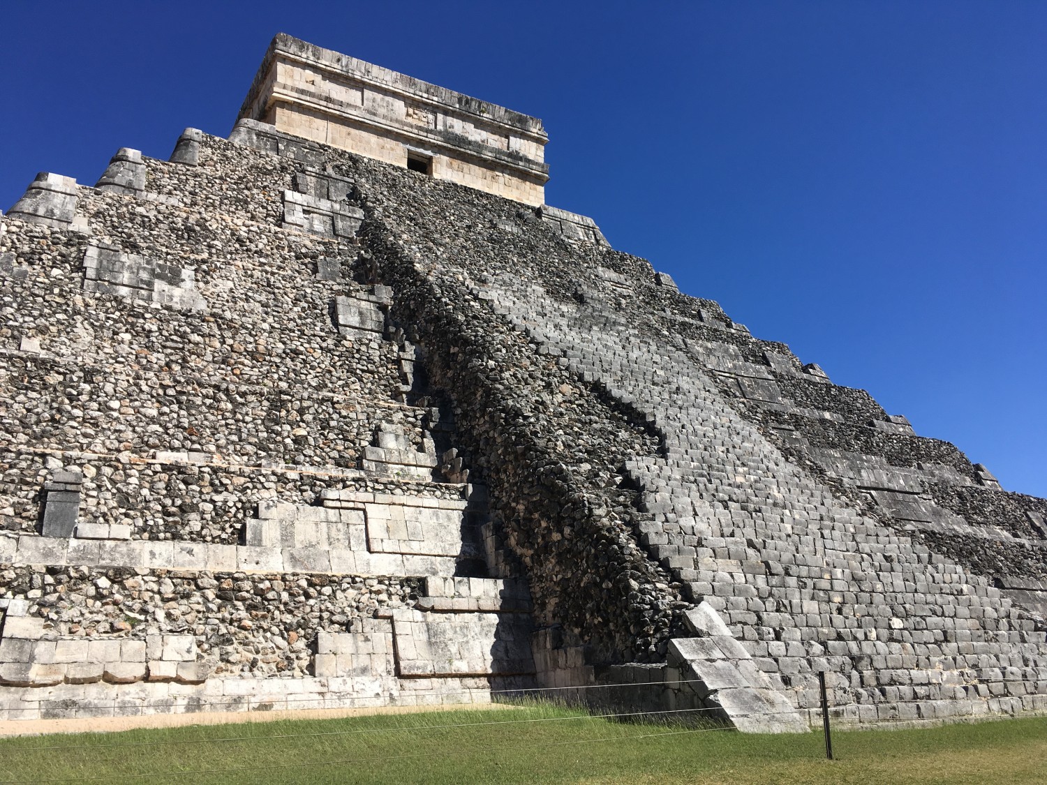
The Chichen Itza pyramid (called El Castillo or Kukulkan) was built around 800-1000 AD as a three dimensional representation of the Mayan calendar. The pyramid faces slightly east of true north. Its positioning is believed to account for the roughy 23.5 degree tilt of the earth on its axis. It has 365 steps representing the solar calendar year (91 steps on each of four sides plus the top). Research using imaging is still exploring the insides of the pyramid. However, our tour guide indicated that there is a similar but smaller pyramid inside that has 260 steps representing the lunar calendar. Finally, he also indicated that here is a third even smaller pyramid inside the second pyramid with 52 steps representing the weeks in the solar year.
365 steps comprise the three dimensional mayan calendar at chichen itza
a snake appears during the equinox
Even more amazing, it forms a snake shadow twice a year during the equinox on September 21 and March 20. The snake appears to slither down the pyramid and connects to the head of the snake statue at the bottom of the pyramid before disappearing. How could an ancient people construct such an amazing three dimensional calendar? Thousands of Mayan people gather at the Chichen Itza pyramid twice a year to watch this amazing event.
during the equinox, a shadow of a snake body slithers down the pyramid and connects to the statue of the snake head
The walls of the pyramid and surrounding structures also create amazing acoustical echos. This enabled ancient Mayan leaders to speak to all of the people as they gathered around the pyramid. It’s easy to imagine how the leaders would appear godlike as they spoke loudly to summon the snake shadow.
the lost history of chichen itza
Around 1250, the city of chichen itza collapsed and the people appear to have left or disappeared for unknown reasons. Speculations include drought or conquest by rivals. After the Mayans left, the jungle trees grew and covered Chichen Itza causing the stone structures to fall apart. It wasn’t until the 1800s that an American archaeologist explored the area and wrote a book that reignited interest in the ancient Mayan city. In the 1900s, Mexican archaeologists began restoring it and it was opened to the public.
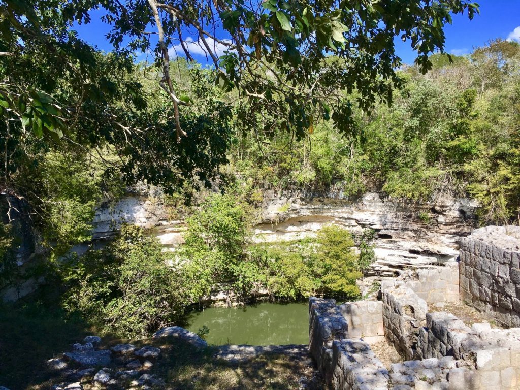
cenote sagrado – a sacred natural sinkhole at chichen itza
Unfortunately, much of what we know about the ancient Mayan civilization is speculation. When the Spanish arrived in the Yucatán in the sixteenth century, they burned the recorded Mayan history because they did not approve of their belief in many Gods.
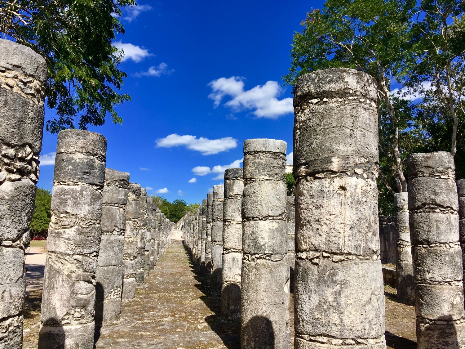
the plaza of a thousand columns at chichin itza
The Mayans continue to amaze me though. Everywhere I travel I buy my daughter a turtle figurine. I don’t know why she likes turtles but she does. On this trip, I was so amazed by the Mayan culture that instead of a turtle, I ordered a personalized Mayan lunar horoscope and astrological chart for my daughter’s birth date. When they delivered the calendar four hours later, guess which animal was on the calendar to represent my daughters date of birth? Yep, the turtle! Coincidence? As I read the Mayan description of the turtle, I was stunned. I could have written it myself about my daughter.
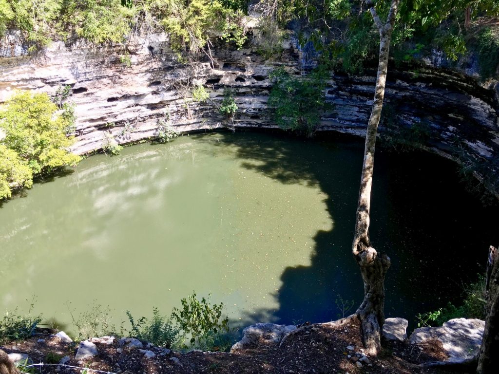
cenote sagrado – a sacred water hole at chichen itza
how to see the chichen itza pyramid?
Chichen Itza is about 2.5 hours from Cancun, Tulum, or Playa Del Carmen by car. We recommend paying for a guided tour as it is hard to fully appreciate the ruins without an expert to explain the astronomical significance of the ruins.
by Keith Wiley | Jan 30, 2017 | Adventure
from nevada to arizona on a surfboard?
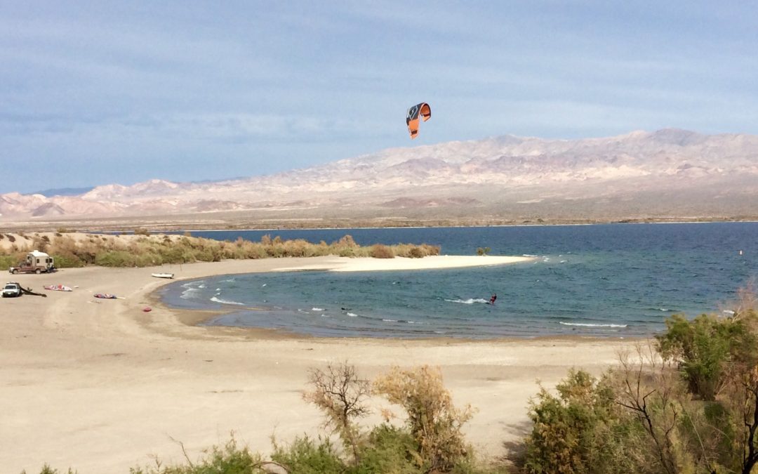
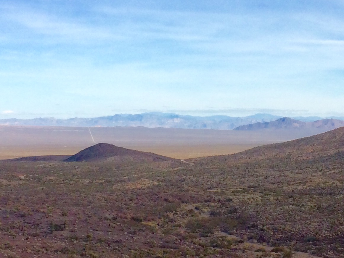
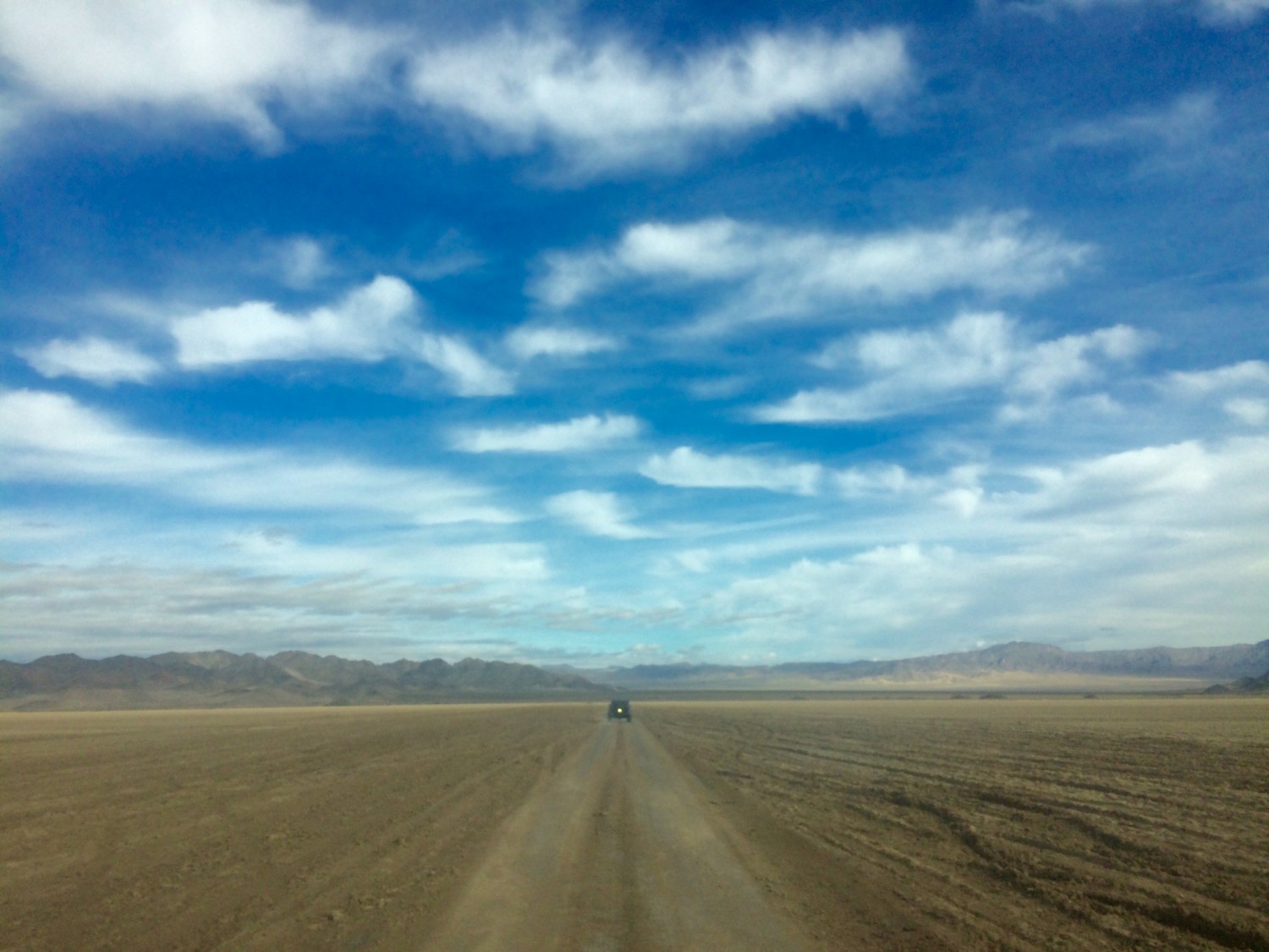
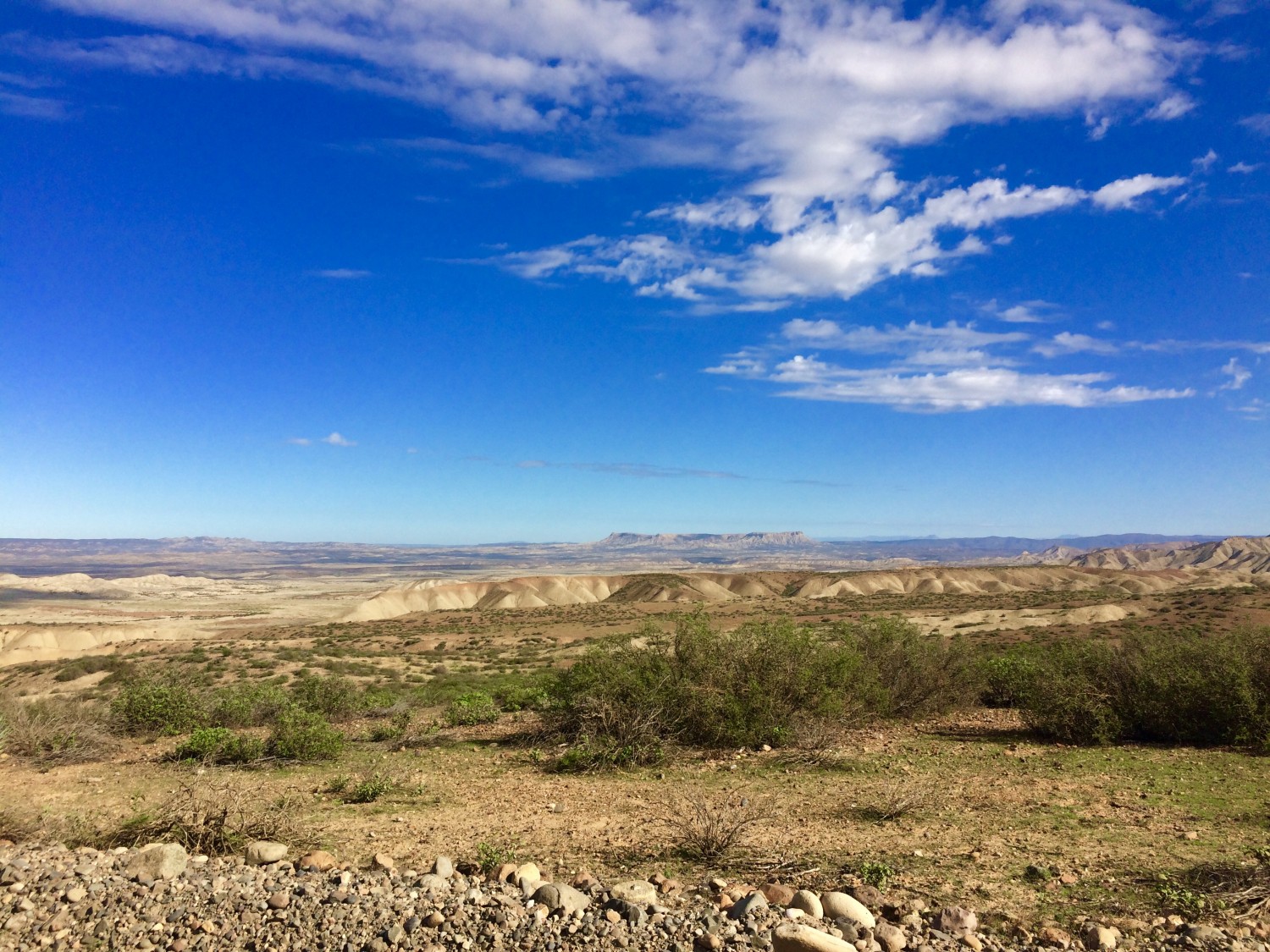
Probably the only benefit of being an occasional gambler is that you can get free hotel rooms. I had just completed an incredible three day jeep expedition through the Mojave Trail that finished in Laughlin Nevada. Since I was in the area, I booked a free hotel room in Vegas for a few nights because how could I go wrong there (said no one ever)? The desert scenery along the Mojave Trail and Red Rock Canyon was beautiful, but it was time for some water in my life. Kitesurfing Lake Mohave was on my bucket list. It would be my first time crossing state lines on a surfboard.
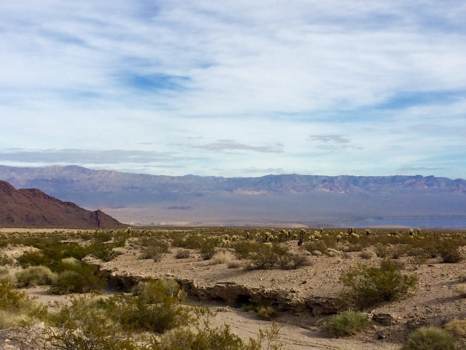
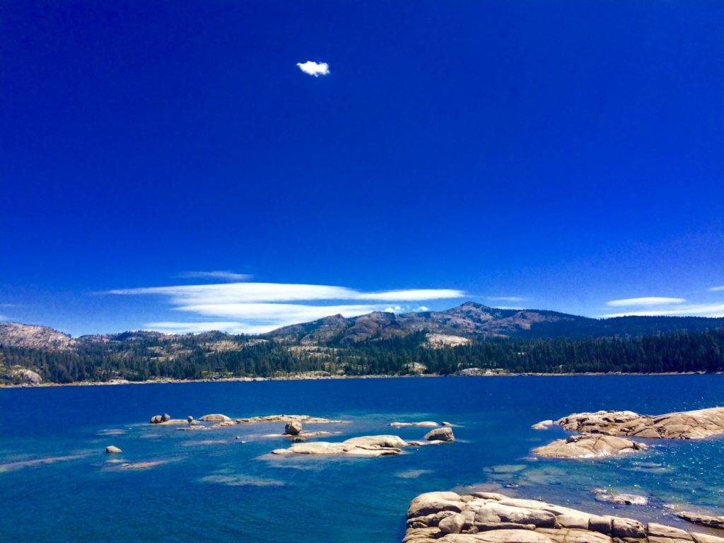
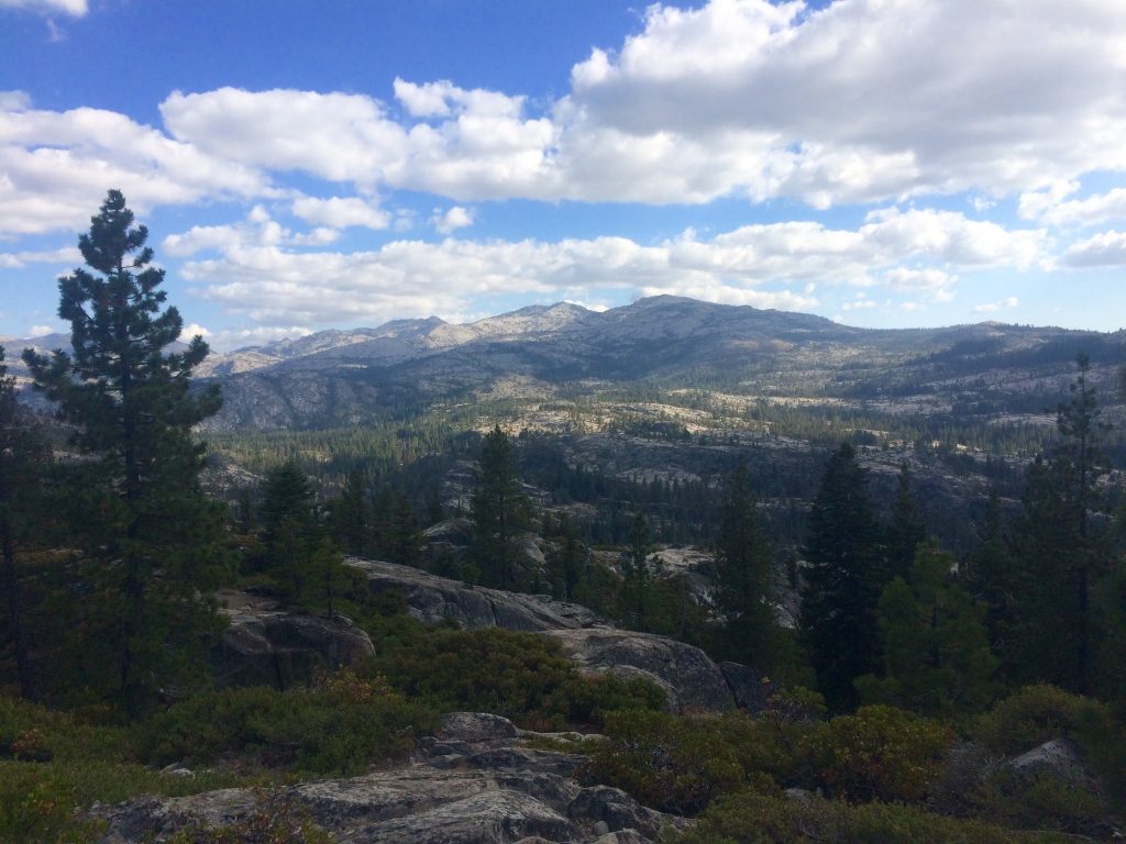
Lake Mohave from a distance
I had heard about people kitesurfing Lake Mohave, about an hour south of Vegas where wind speeds of 30-40 mph were common. I had also read that kitesurfing Lake Mohave could be dangerous and that several kiters had been seriously injured there. Extreme gusts of wind can unexpectedly launch kiters into the air with no telling where they will land. Since the border between Nevada and Arizona runs right through the middle of the lake, you could literally get launched into another state. It didn’t sound like ideal conditions, but I’m usually up for adventure and seeing new places. Plus, how often do you get to kite surf from one state to another?
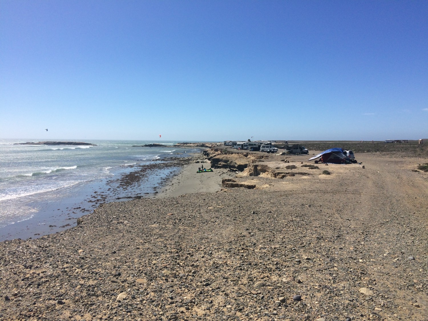
6 Mile Cove at Lake Mohave – dead calm water with no wind (the mountains across the way are in Arizona)
it’s not an adventure if you don’t get lost
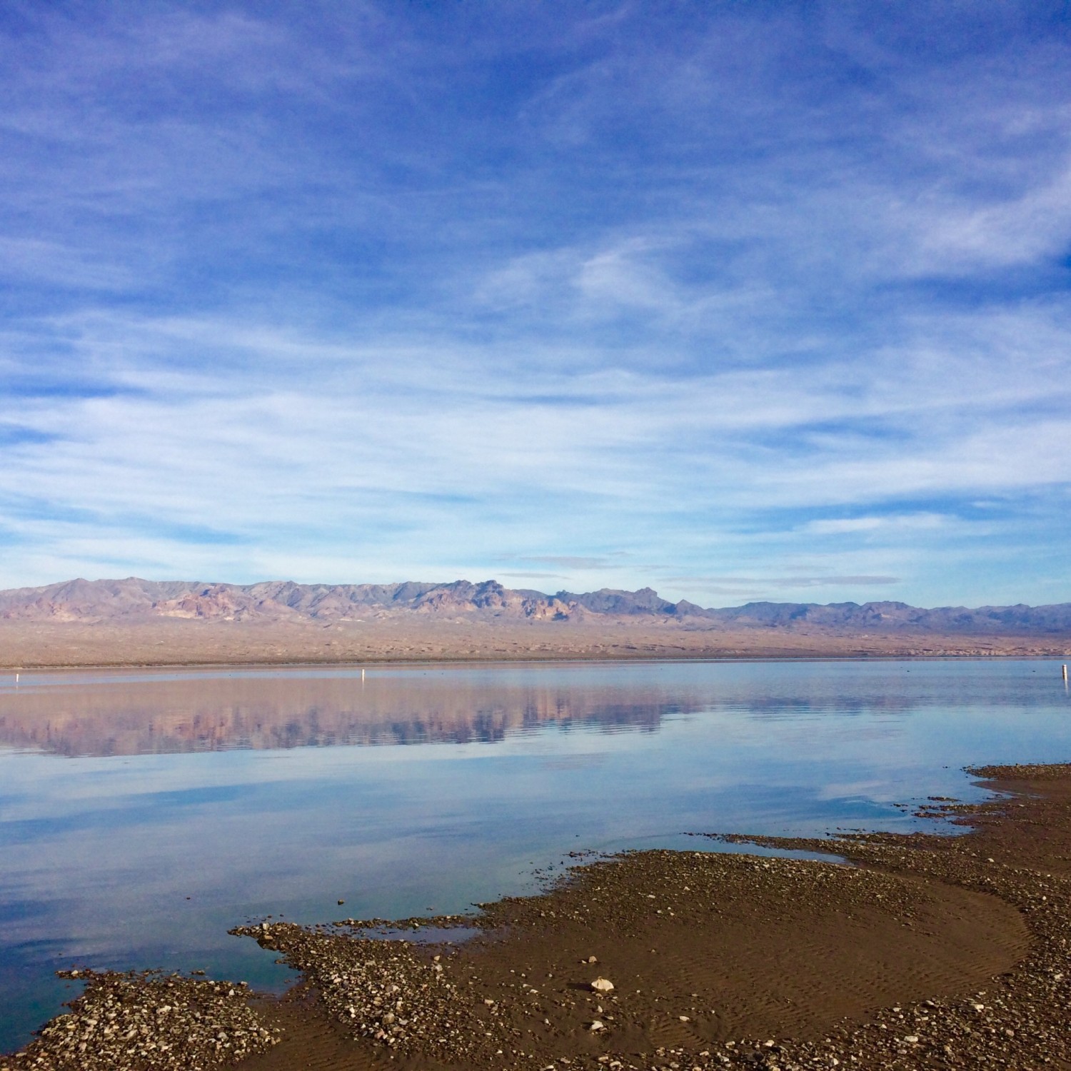
Siri doesn’t know this area very well though so I had to find it the old fashioned way. I drove around, made wrong turns, and asked locals when I got lost. Fortunately, driving around Nevada is so beautiful that you don’t mind getting lost. My first missed turn took me to Cottonwood Cove boat docks, at Lake Mead. I couldn’t believe how quiet and peaceful it was there. I laughed at the irony that no one was there on probably one of the best days of the year.
That’s one of the things about being retired. You avoid traveling during the times when everyone else is because it’s too crowded and costs a fortune then. Sure, the water might be colder, but we have had some of our best experiences visiting places in their off season. The lack of long lines and crowds often make up for the off-season weather or water temps.
Cottonwood Cove – peaceful day in the winter off-season
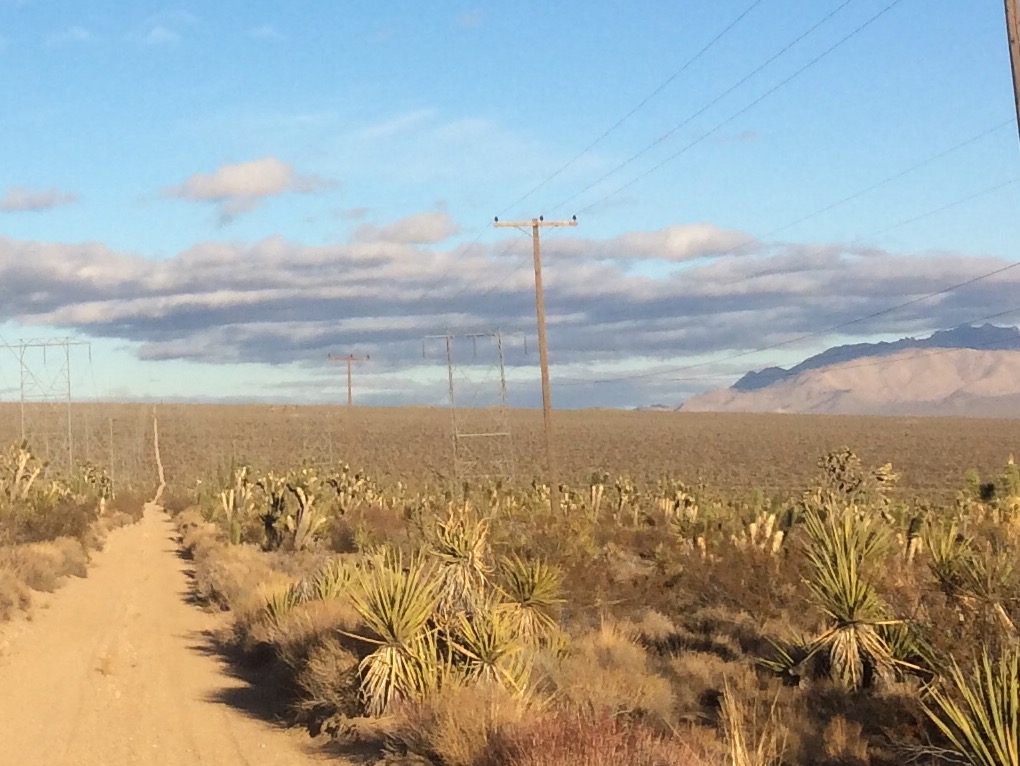
Follow the power lines into the desert
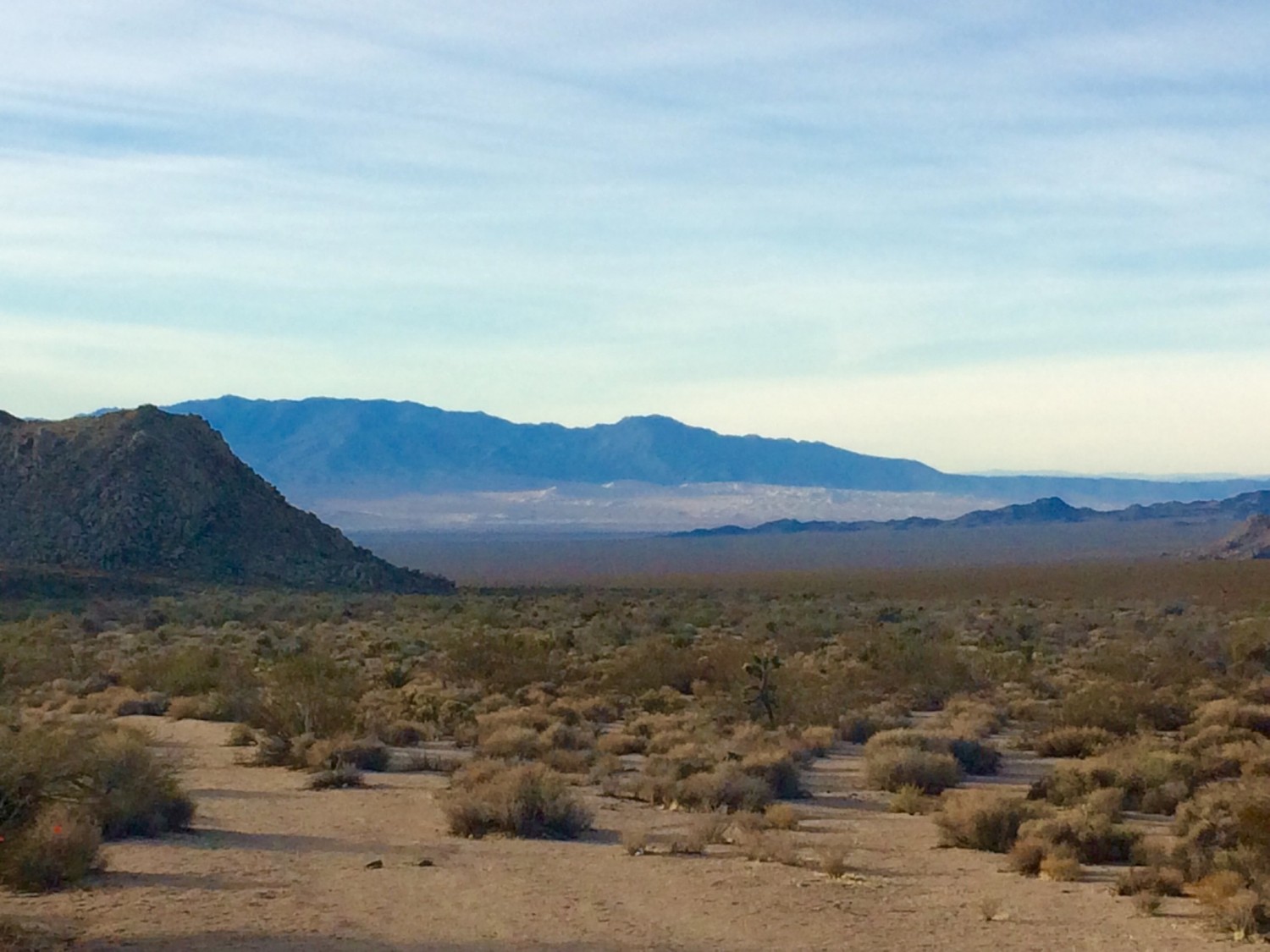
Eventually I found a local who could direct me to 6 Mile Cove at Lake Mohave. He told me to follow the power lines leading into the desert from the entrance to the Lake Mead recreation area. It was a long and bumpy dirt road for my Prius to handle. I figured there was a good chance my car would get stuck in the middle of the desert. However, I had come along way and wanted to check kitesurfing lake mohave off my bucket list.
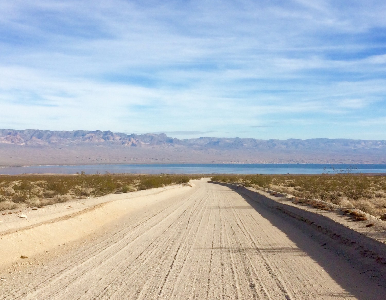
the long dirt road to 6 Mile Cove at Lake Mohave
the friendliest sport on earth
When I arrived, there were only two other kiters camping there and an RV. The lake was as calm as could be, not even a light breeze. The forecast called for wind though so I killed time with the other two kiters I met there while we waited for wind. Kitesurfing is one of those sports that brings strangers together. I love regular surfing, but it’s a crowded sport, and nobody wants to see another surfer arrive at their surf break. There’s not a lot of kite surfers in the world though, and so local kiters generally welcome new kitesurfers to their area. This could change in twenty years if the sport gets too crowded.
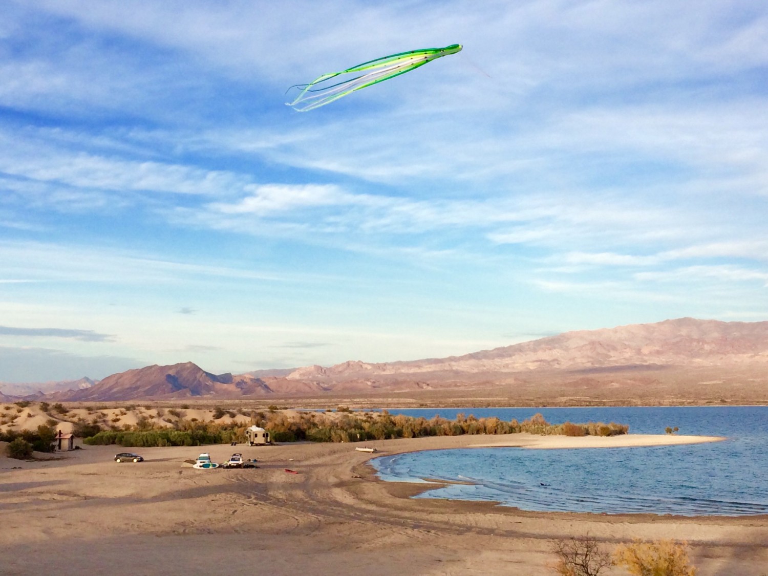
flying a wind meter kite at 6 Mile Cove – Lake Mohave (waiting for real wind)
kitesurfing lake mohave – let there be wind!
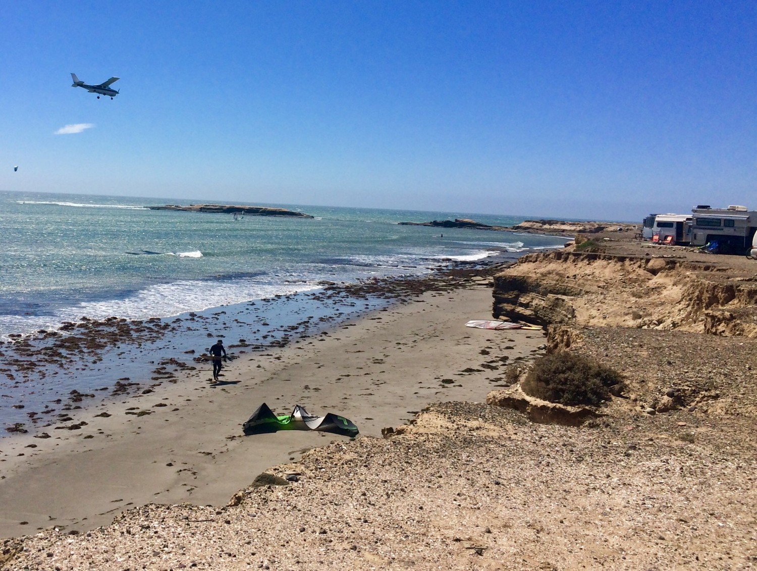
The wind didn’t arrive until noon on my second day at 6 Mile Cove. It was dead calm when all of a sudden someone somewhere turned a switch and the wind kicked up to 20mph. I had never seen the wind and water change so dramatically in a matter of seconds. Out on the water the three of us had 360 degree views of Incredible mountain scenery all to ourselves.
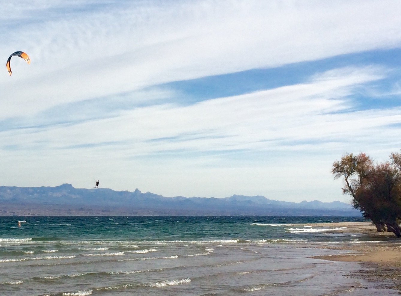
a new friend catching some big air at Lake Mohave
That night I was back at the tables in Vegas because that’s what gamblers do. Even though I lost $200 that trip, I was still grinning as I swapped stories of adventure with the others gathered around the roulette table.
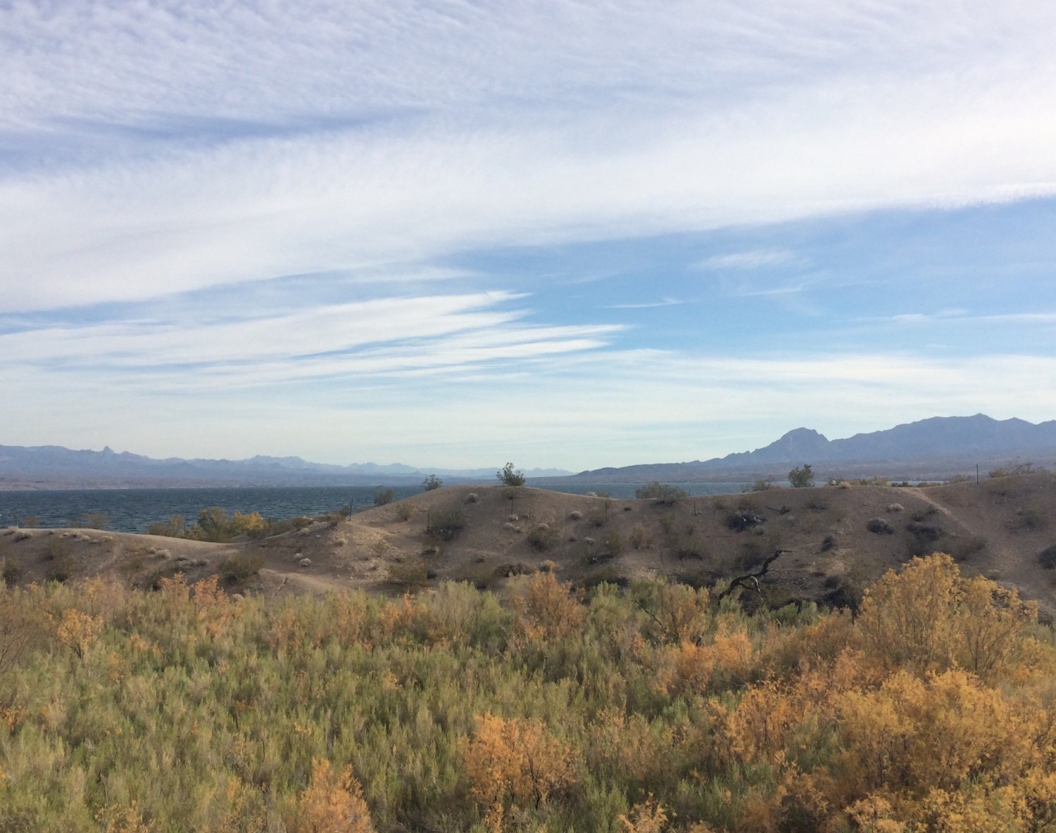
hilltop view of 6 Mile Cove at Lake Mohave
by Keith Wiley | Dec 17, 2016 | Adventure
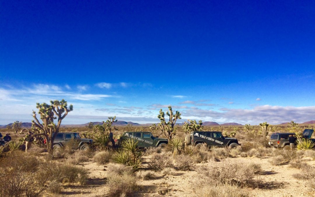
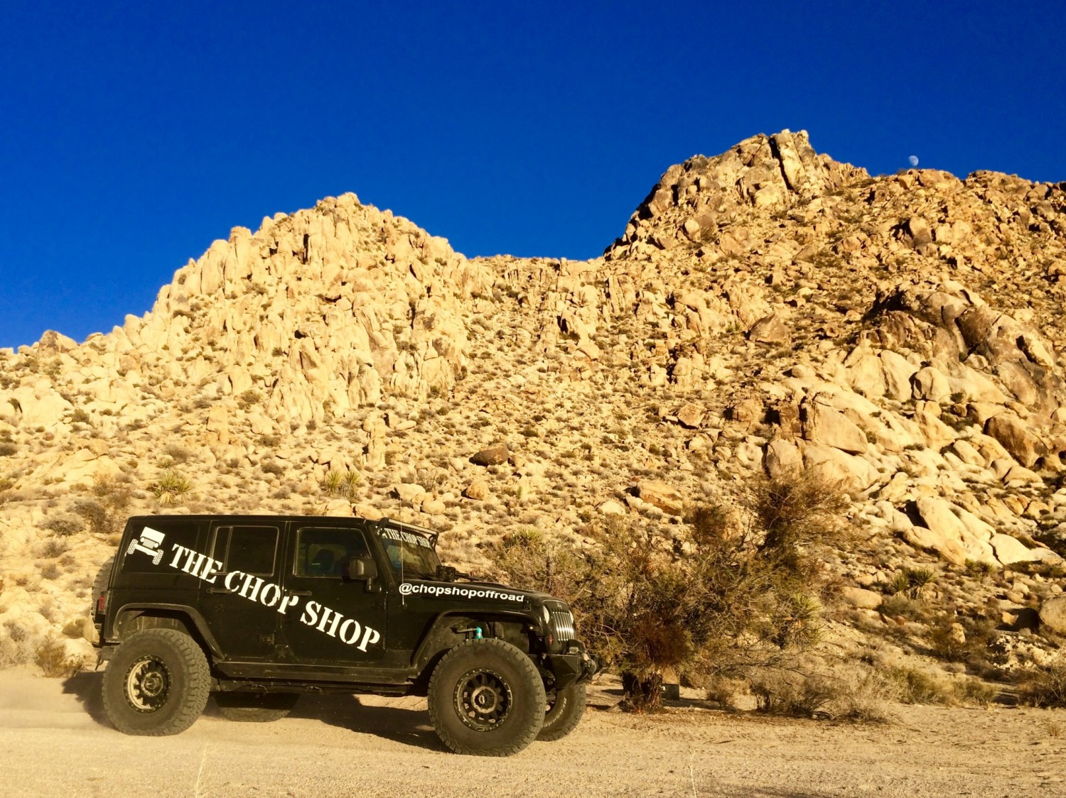
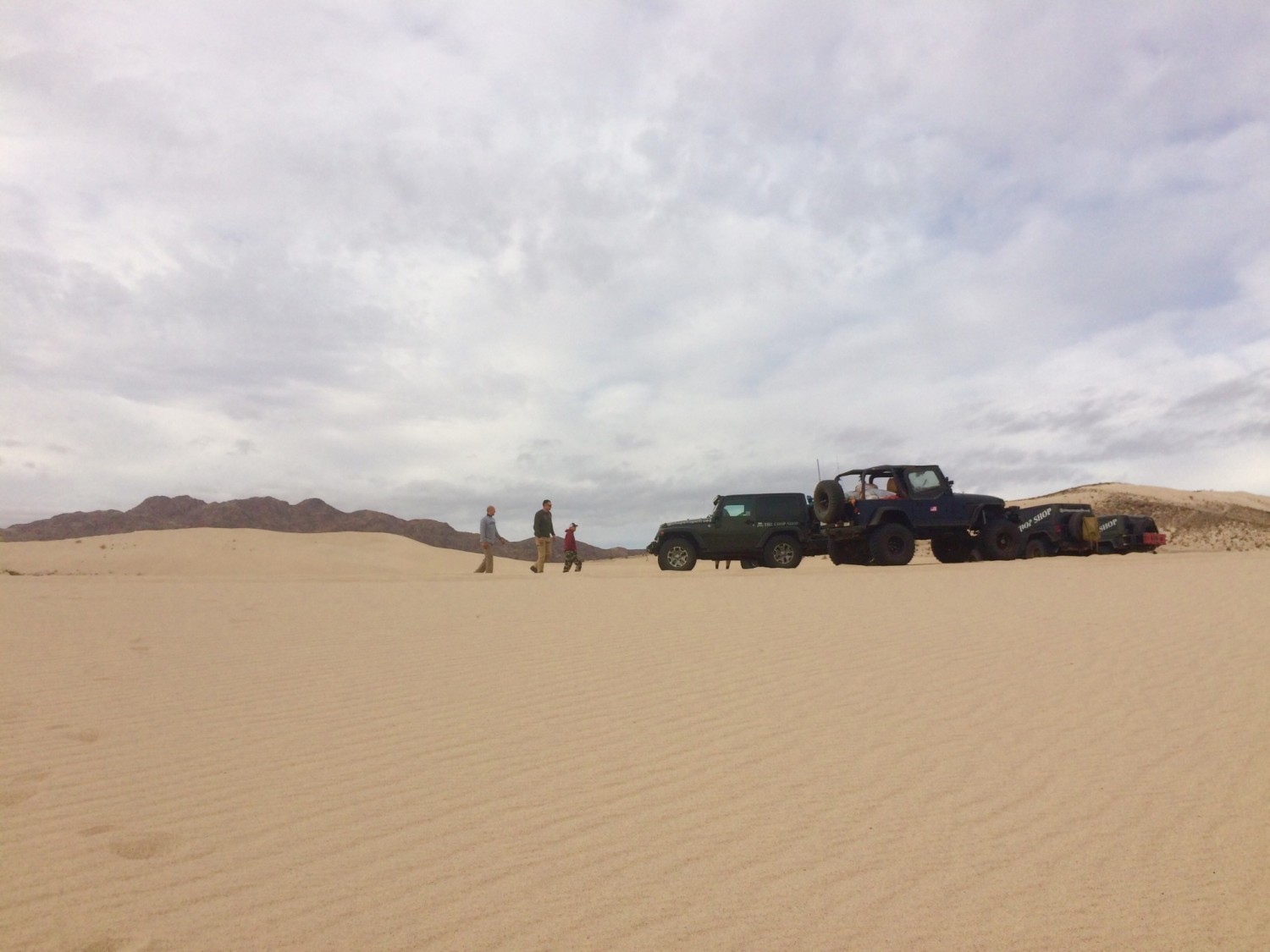
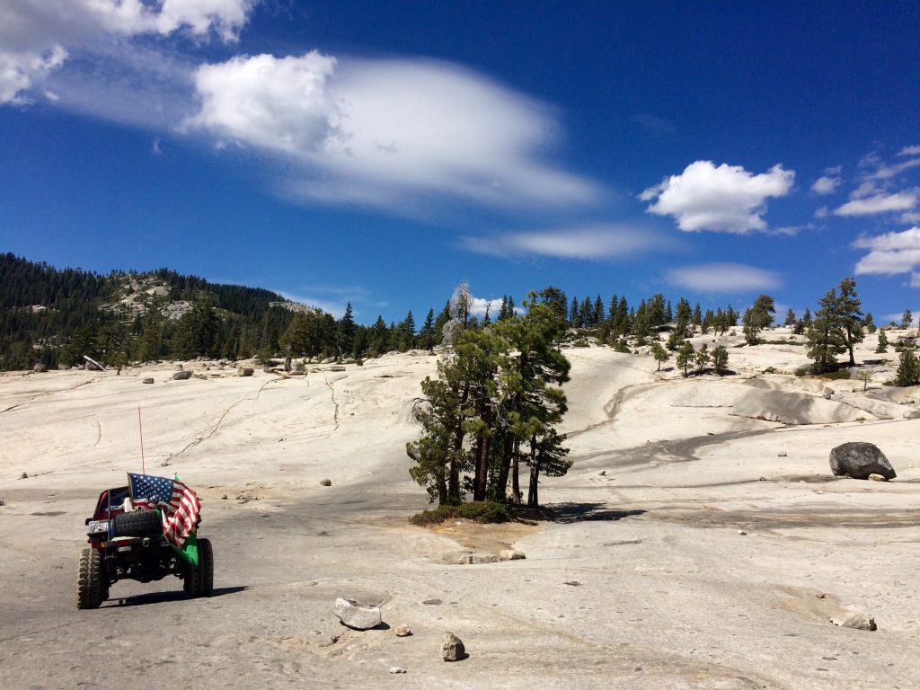
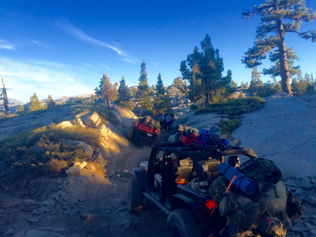
5 jeeps and a prius in the mojave desert
Life doesn’t hand you a lot of gifts. Even when it does you have to have the insight to recognize them and the motivation to seize them. When Sesar put the word out that he was gonna jeep the Mojave Trail, I pulled some strings to make sure I could be there.

Did I even know what the Mojave Trail was? Not at all, but I knew it would be an experience that I didn’t want to miss. I stopped collecting assets 4 years ago and started collecting experiences instead. Sesar took me on my first jeep expedition a few months earlier to the Rubicon trail. That trip opened my eyes to the beauty and excitement of exploring nature from the comfort of a jeep. While it doesn’t provide the health benefits of hiking, you can cover more ground and it’s easier to carry beer.
I’ve never been a jeep enthusiast and never had an interest in cars. It’s an expensive hobby and requires mechanical know-how. We have always owned practical cars like the Honda Civic and the Prius. Sesar hates practical.
dude, send me the bleepin’ details!
He sent just one text a few days before the trip that said “bring a backpack of supplies…needed to survive.” I was hoping for a detailed pack list and trip summary, but just as I had hoped the selfie craze was a fad, I was sorely disappointed. It took my whole family blowing up on him with angry emoji texts to eventually get a few details. Up until two days before I left we didn’t know when or how I would get home and that I needed to bring my own food.
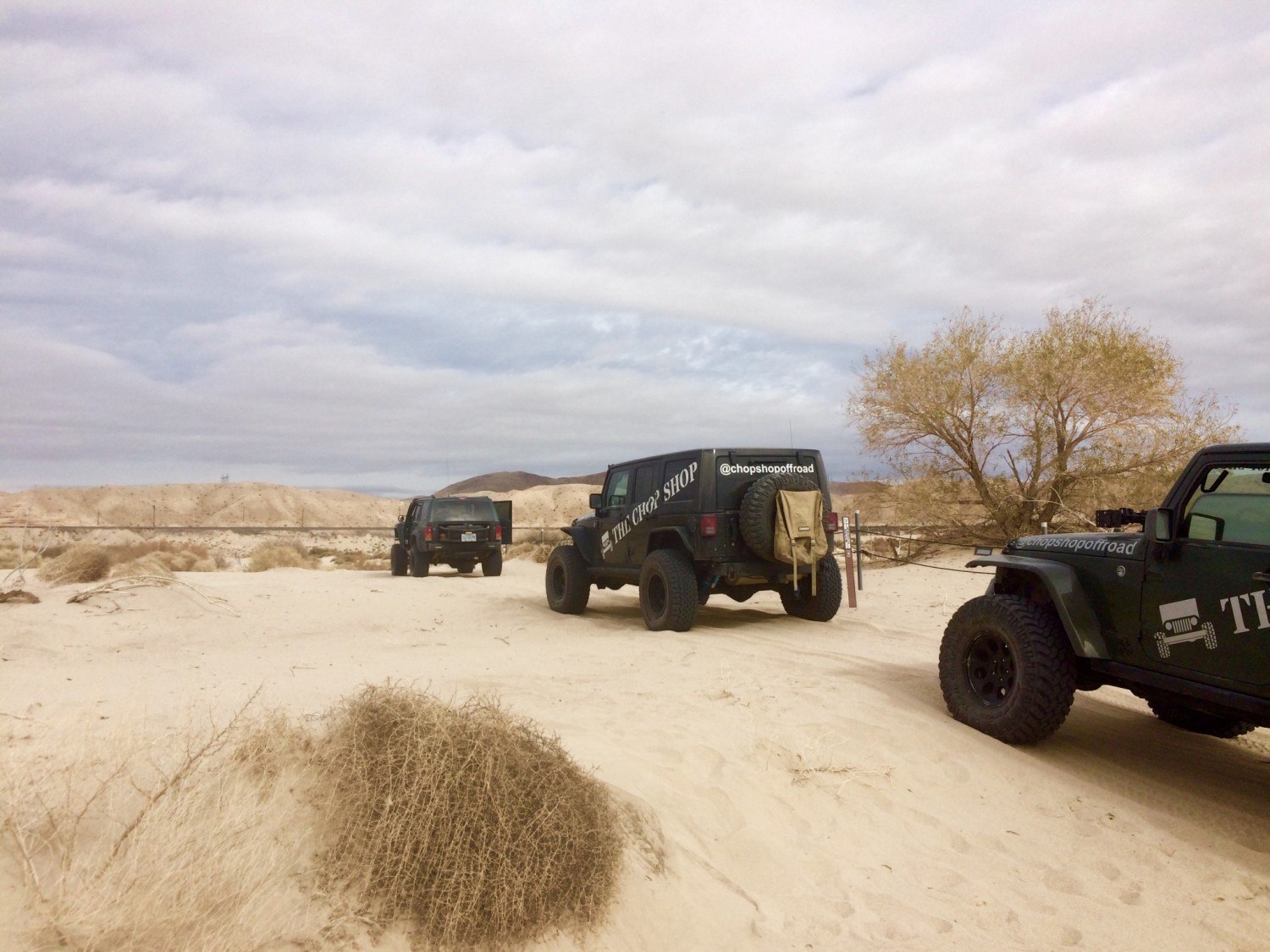
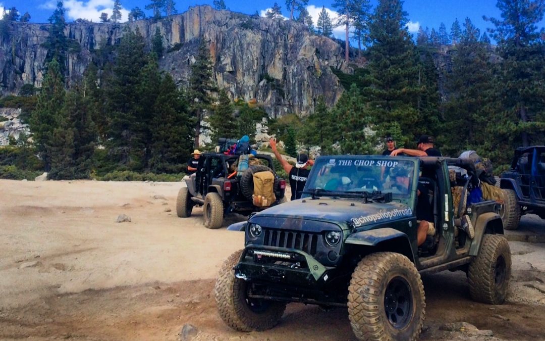
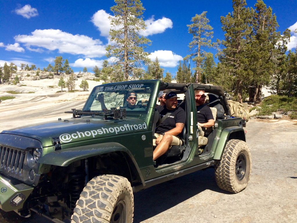
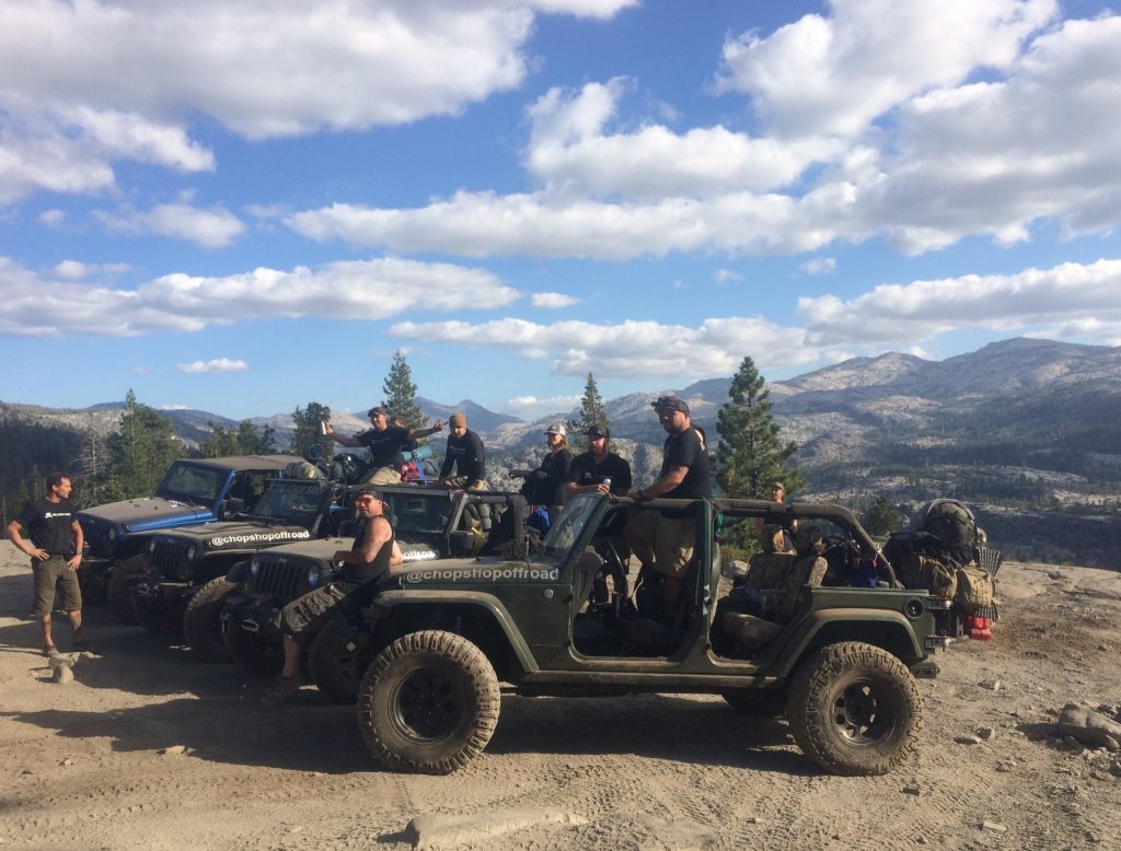
There would be 7 of us on the Mojave Trail in 5 jeeps. When was the last time you were able to get 7 adults together to go on a 3 day expedition? Sadly, few people have the time to get away from the money grab of life. I guess it takes the commanding leadership of an off-duty army officer to pull off this type of feat. Either way, Sesar and The Chop Shop put together one hell of a jeep trip.
many battles were fought on this trail
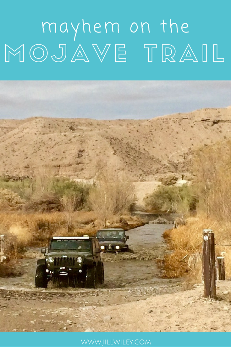
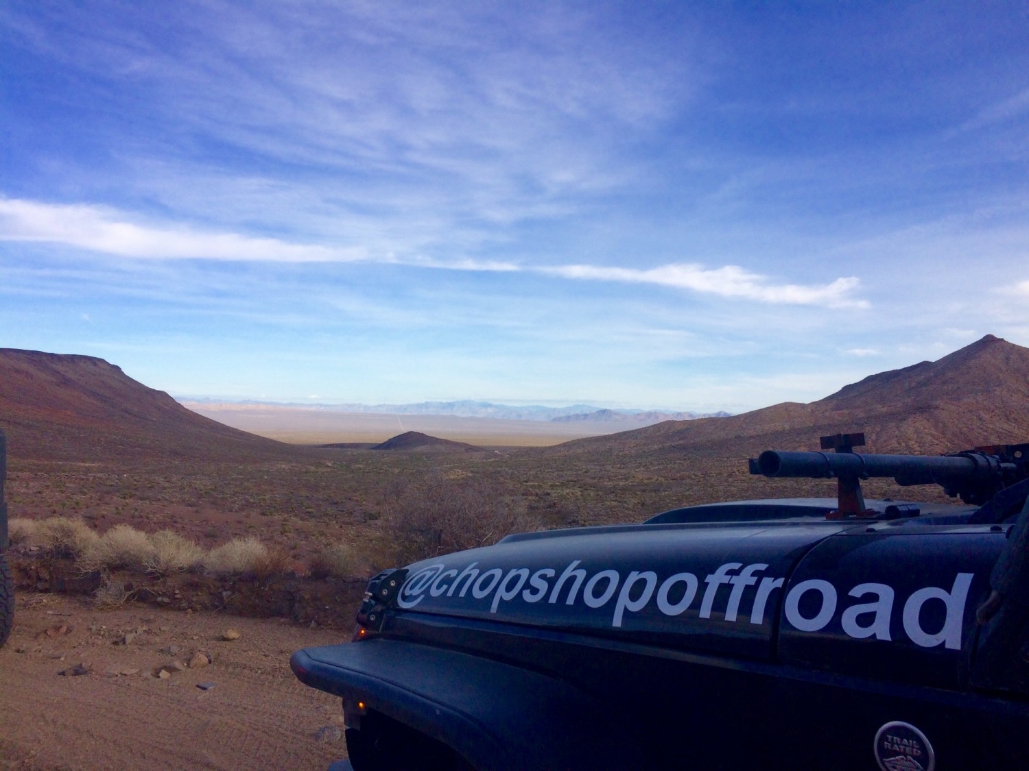
In preparation, I did some rigorous research on this new website I found called Wikipedia. I also yelped it and asked Jeeves but was not nearly as successful there. Anyways, I learned that the Mojave trail is a 140 mile trading route originally created by native Americans that connects the various watering holes in the Mojave Desert. It starts near Laughlin and finishes at Barstow.
It was later used by Spanish missionaries and every other foreign colonizer that came to the area including American pioneers and forty-niners heading west to find gold in California. It’s a true Wild West trail where many confrontations occurred between Native Americans and incoming colonizers. Think of The Lone Ranger and the stuff that Louis L’amour books are made of, but this is the real deal.
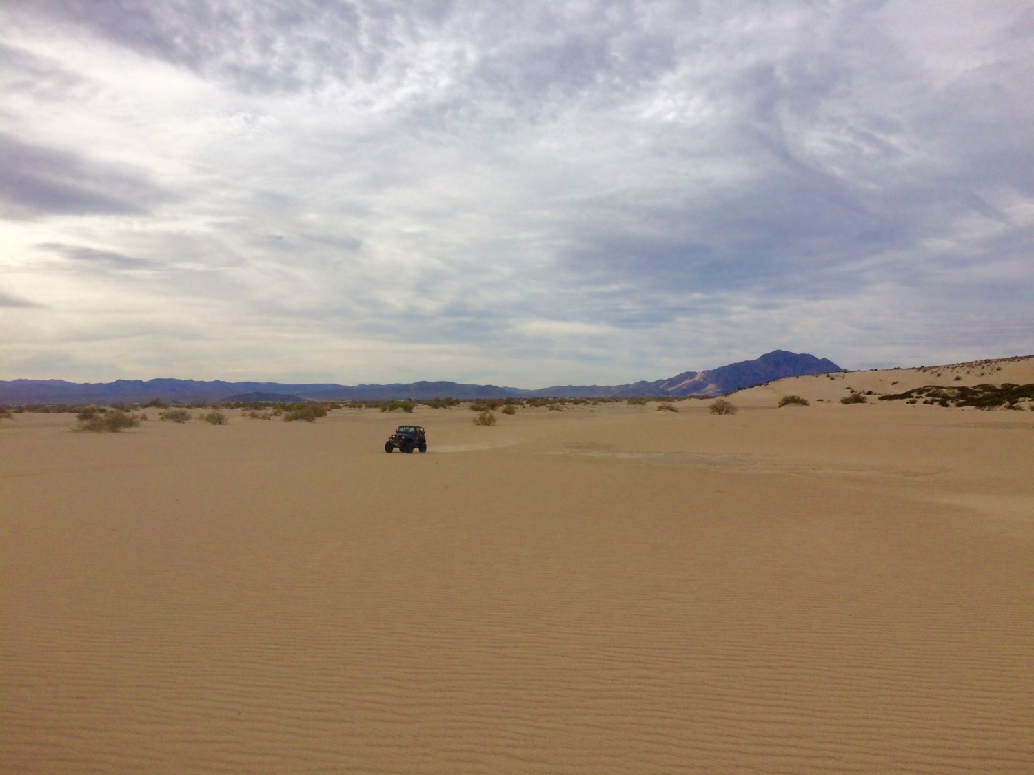
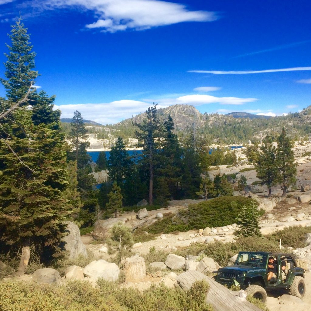
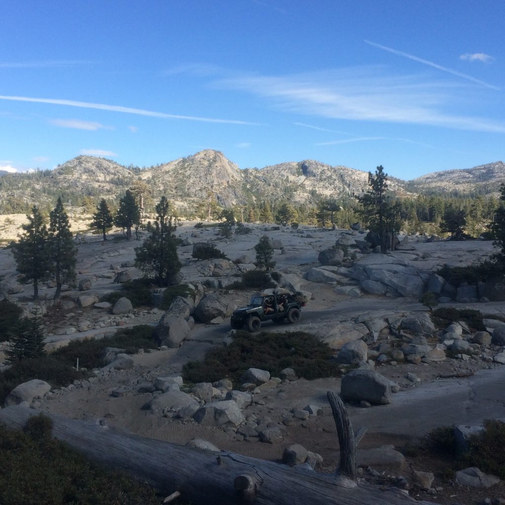
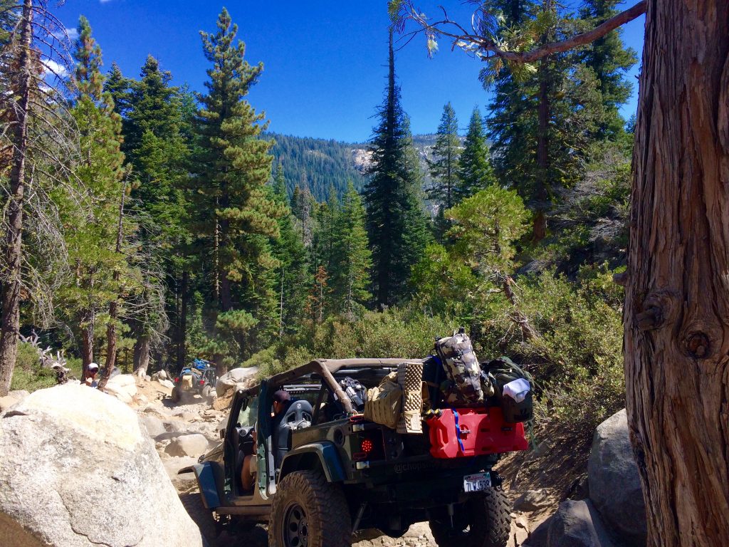
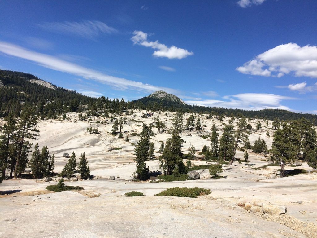
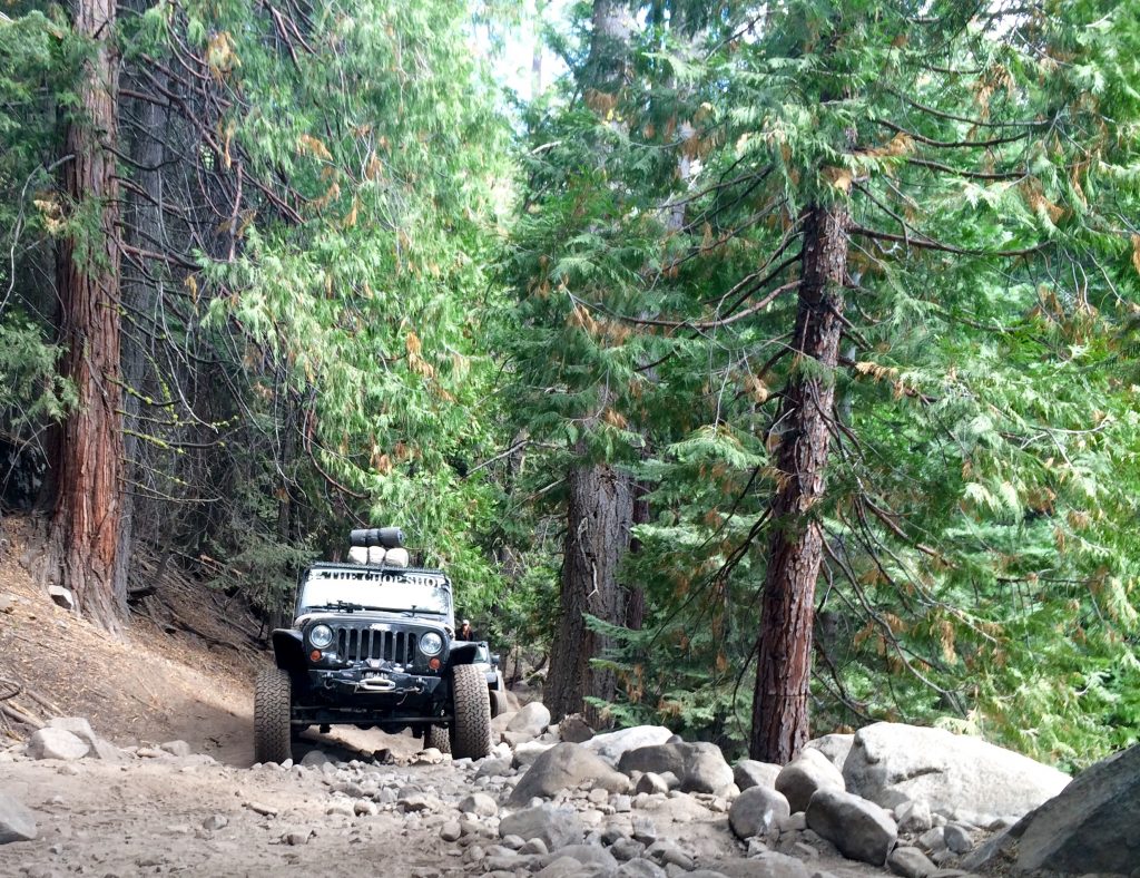
Today, the Mojave Trail is a 4-wheel drive dirt road for us weekend warriors in mid-life crisis. The national preserve is believed to appear much the same as it did hundreds of years ago. It’s not a slow rock crawling expedition like the Rubicon Trail. It’s a high speed adventure through huge expanses of waterless uninhabited desert and thick sand. The primary dangers are the trees and rocks that you have to avoid as you bounce and swerve through the often narrow trail at high speeds.
“i’m a professional”
The other major obstacle is that there are very few markings along the trail so it’s easy to get lost. After reading this, I asked Sesar if he had ever done the trail before. He assured me that he had taken tanks through the trail with the army as well as recreational jeeps. I’m happy to hear this, but a scene from “Ferris Bueller’s Day Off” flashes into my head. I picture the valet who takes a joyride in Cameron’s father’s 1961 Ferrari minutes after saying “Relax…you guys have got nothing to worry about..I’m a professional.”
Nonetheless, after Sesar’s reassurance and after learning about the rich history of the Mojave Trail, I was all in. We had already taken four jeeps rock crawling through the Rubicon trail without getting stuck once. This should be a cake walk. Anyone suspect that I might have just jinxed the trip?
probably the wrong place to leave a prius in barstow
I arrived in Barstow Thursday night and paid to leave my car in a reserved spot intended for 18 wheel trucks at the Flying J truck stop. We laughed at the ridiculous sight of my tiny car parked amongst 30 big rigs in a spot that could fit 5 of my cars. As We drove away in Sesar’s jeep, we imagined what the weary long haul truckers would do to my Prius that was occupying the last reserved spot. They probably wouldn’t think it was as funny as we did.
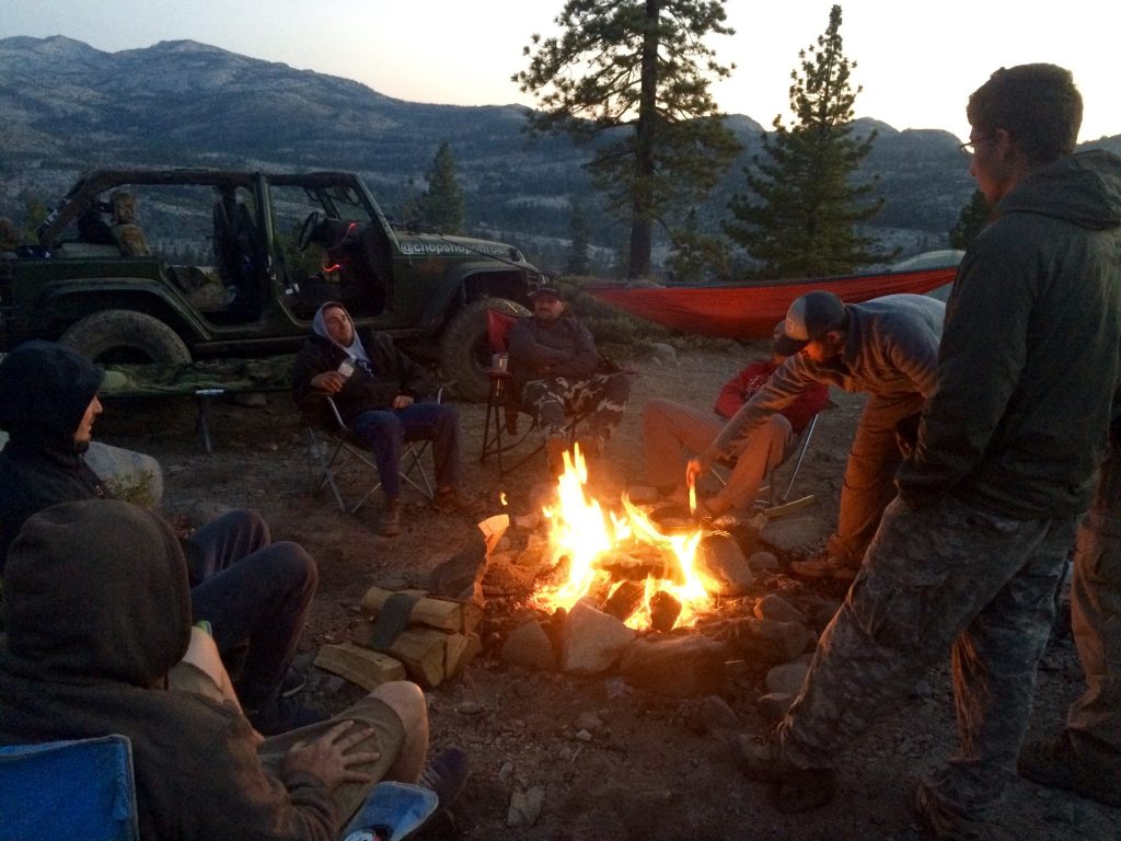
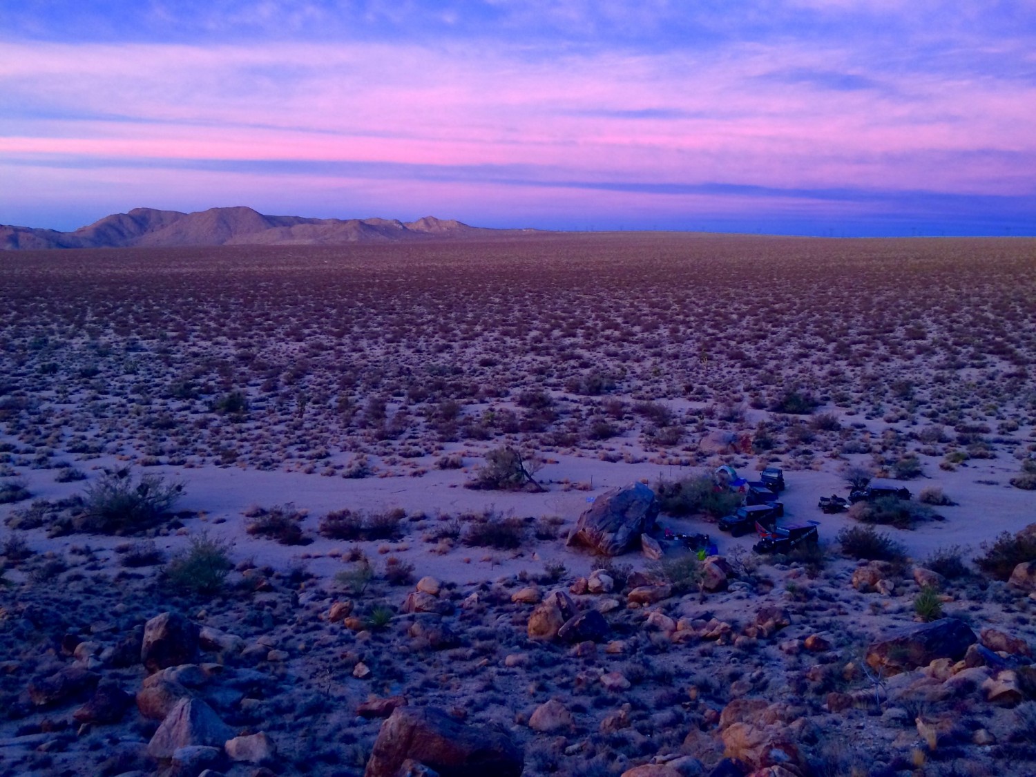
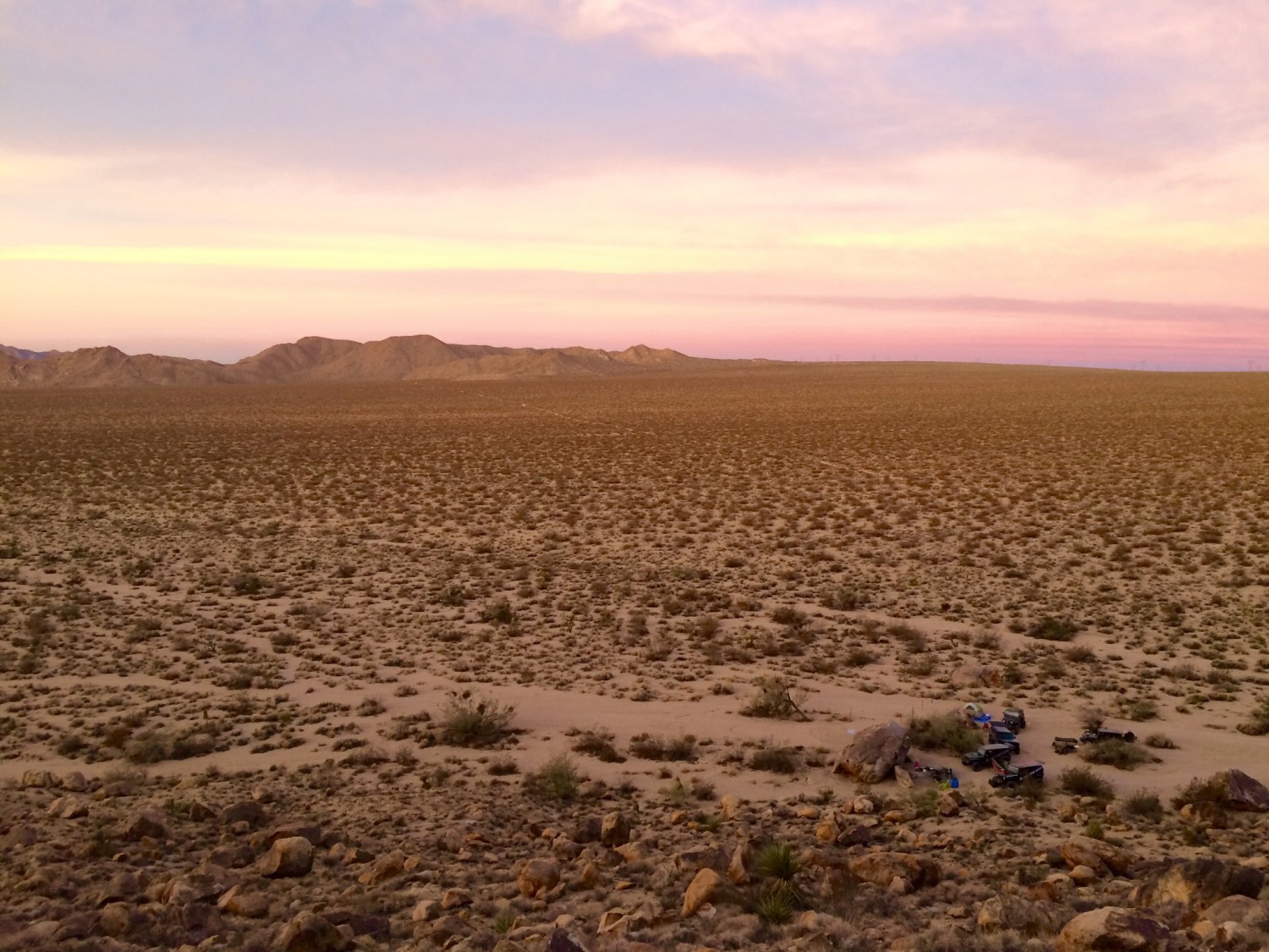
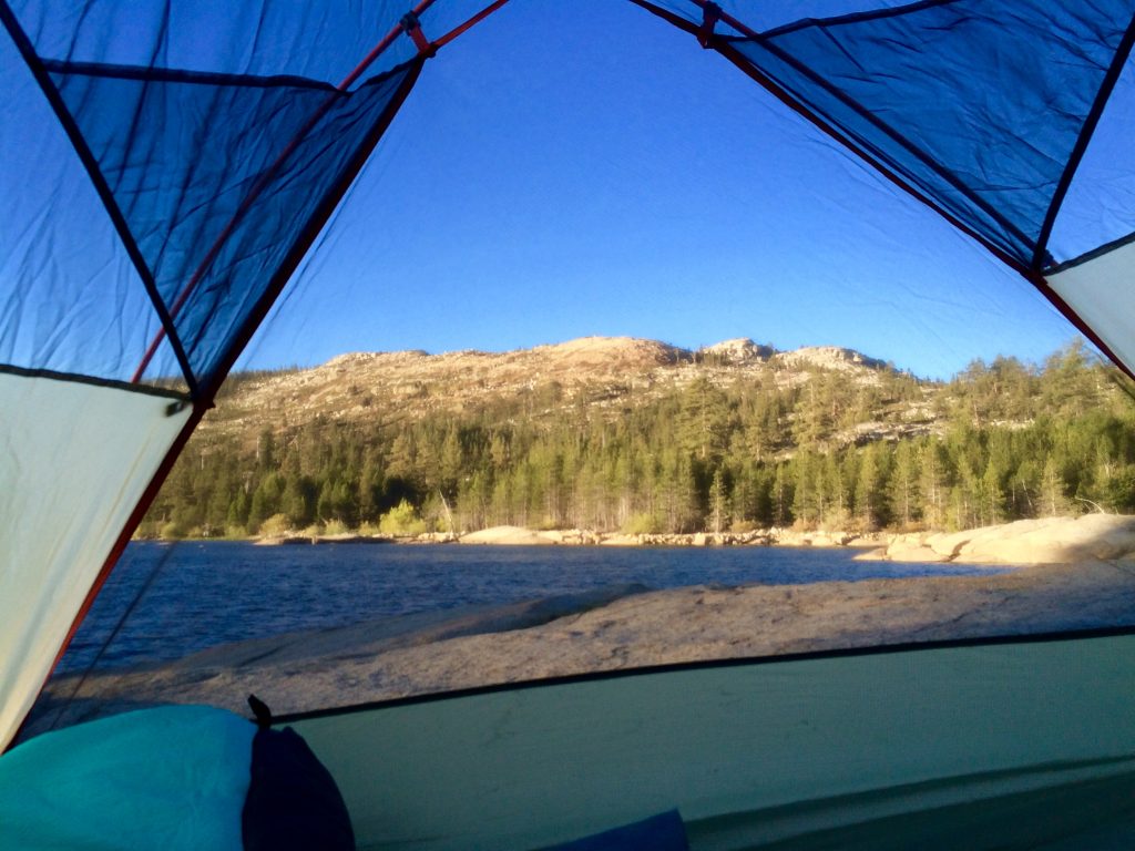
We headed into the desert just a few hundred yards off the highway to camp for the night and wait for the others to arrive. Camping in the desert is so easy. You can just unfold a cot and sleep under the stars with no worries of bears or mosquitos.
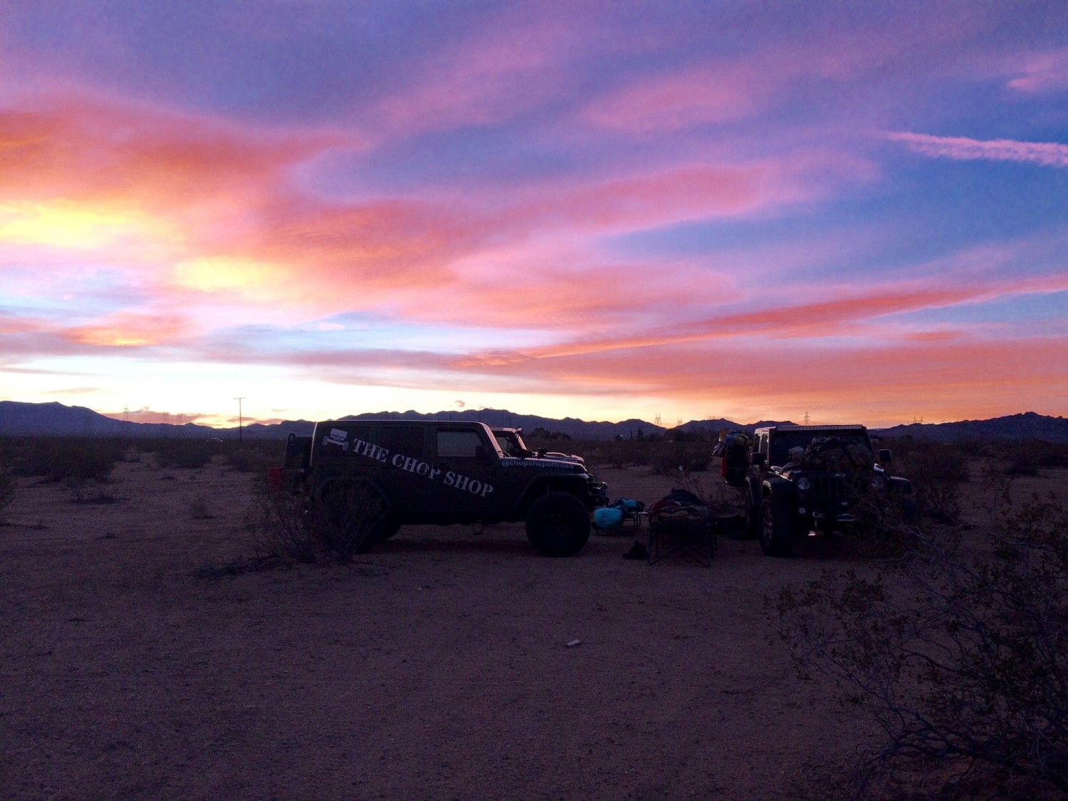
We hung a strobe light so the other jeeps could find us. Eventually, we saw headlights veering off the highway and bouncing into the desert towards us. Let the games begin!
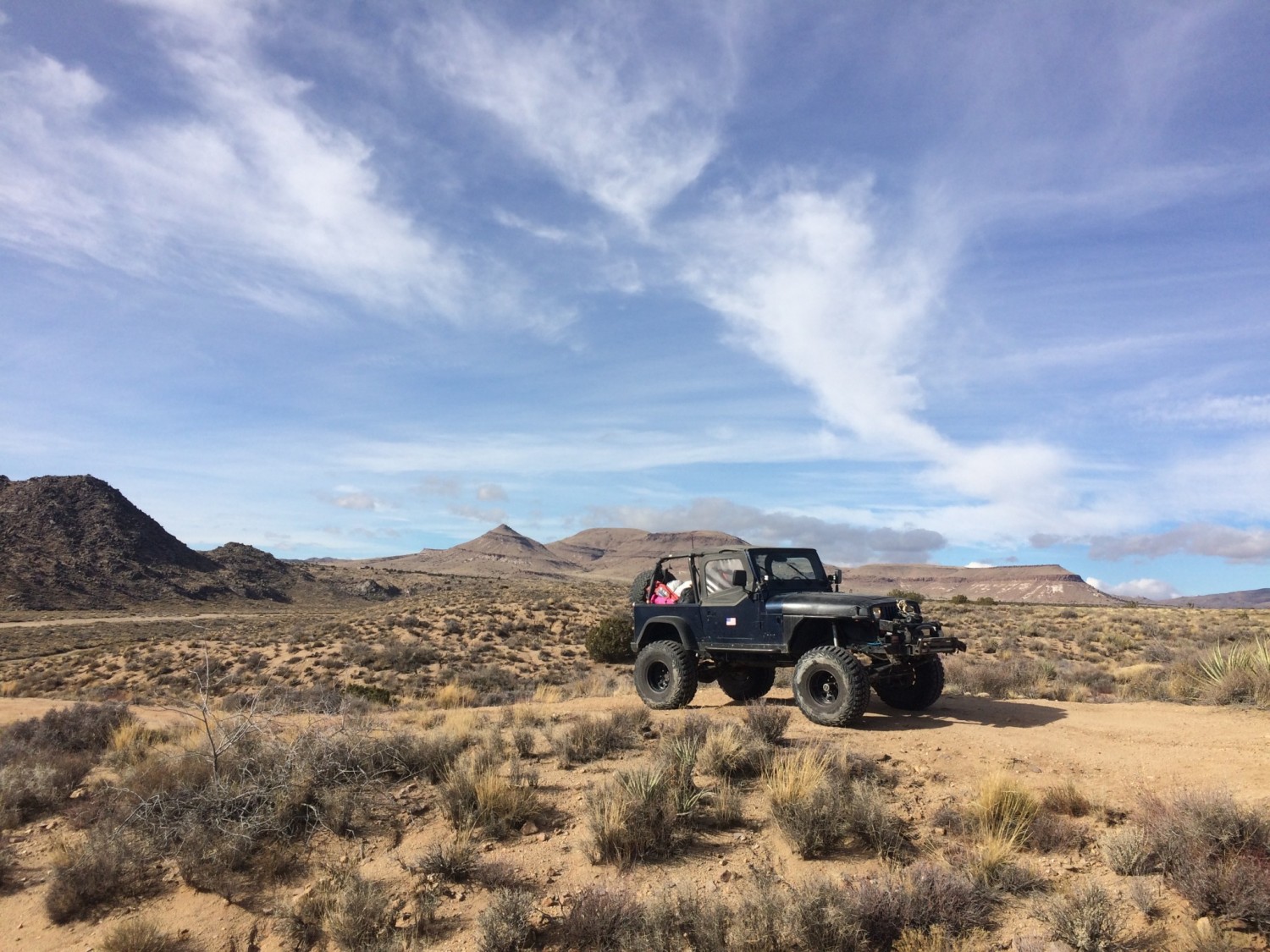
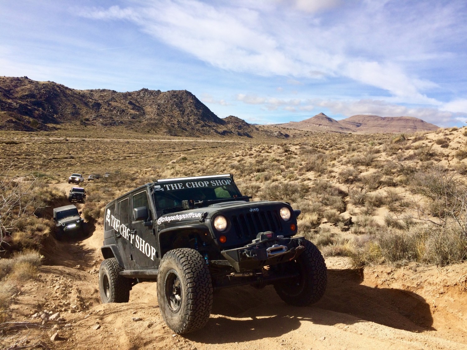
embarking on the historic desert trail
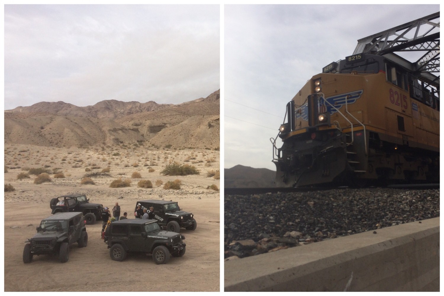
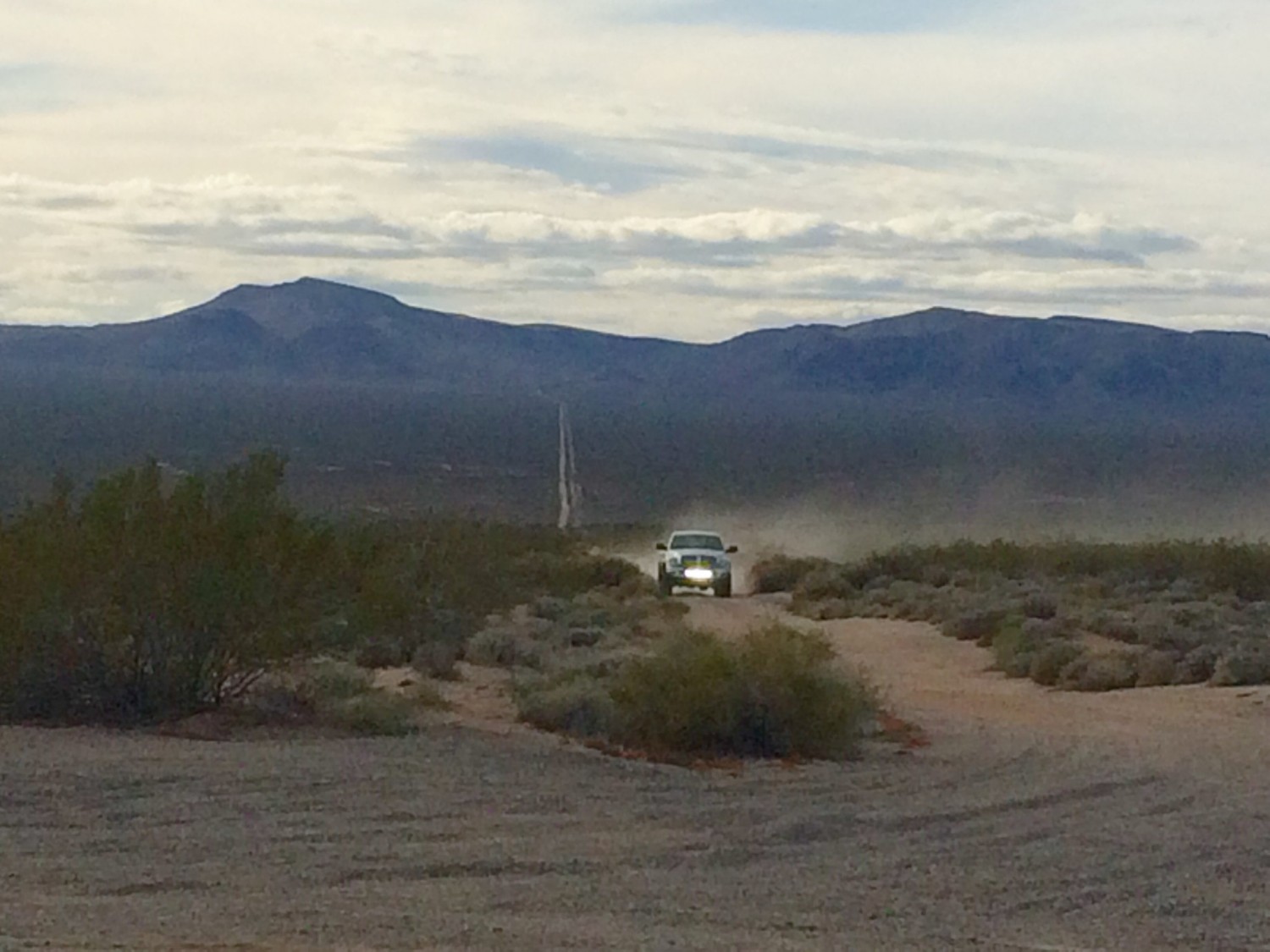
We woke at sunrise and began heading east from Barstow on the Mojave trail. We flew through the desert at speeds ranging from 30 – 70 mph. There is so much dust flying around that you can barely see. If there is a rock in the middle of trail we will be airborne. I double check my seat belt to make sure it is catching properly, and Sesar says “relax, you got nothing to worry about.” Once again, I picture the valet from “Ferris Bueller.”
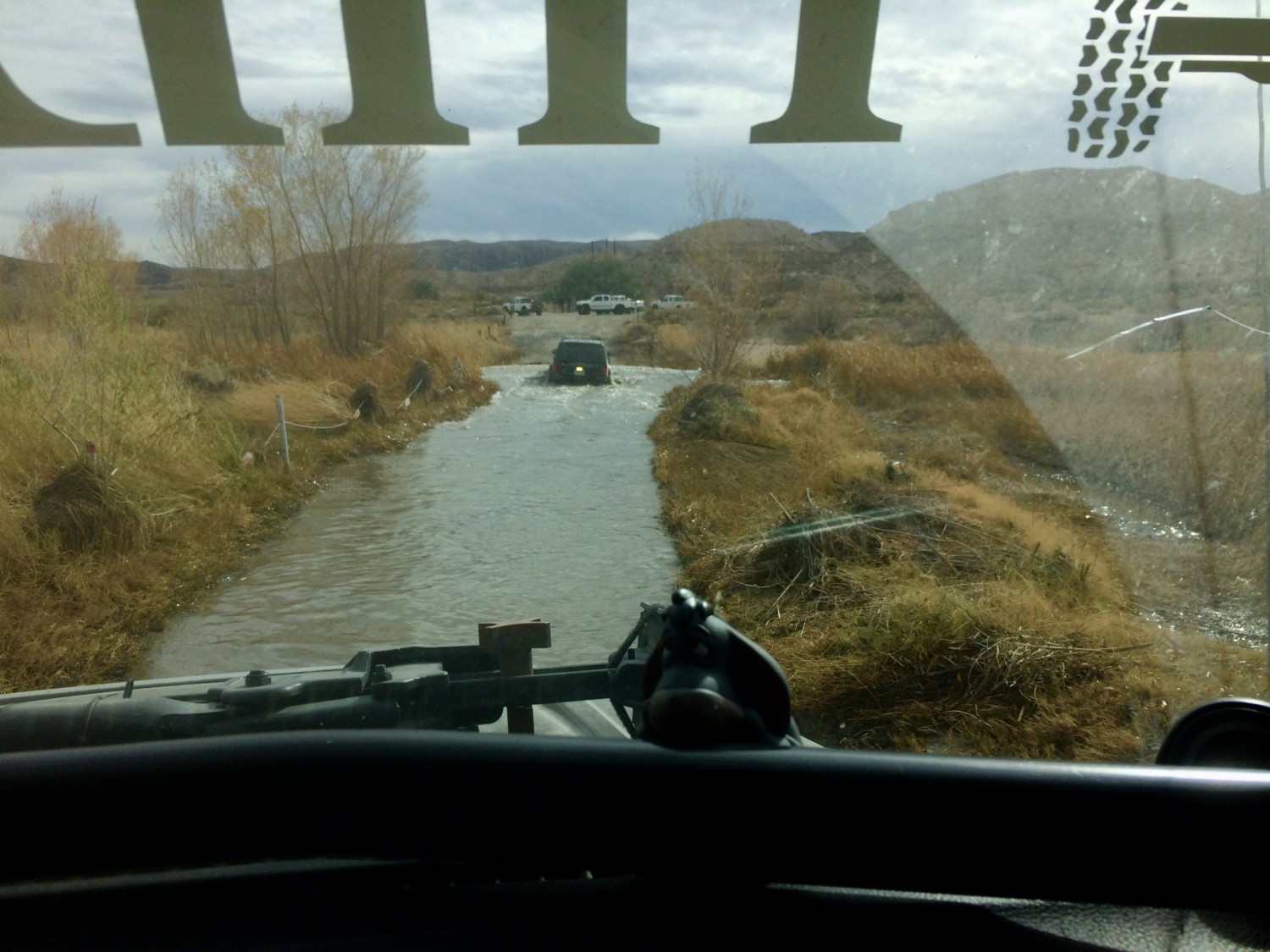
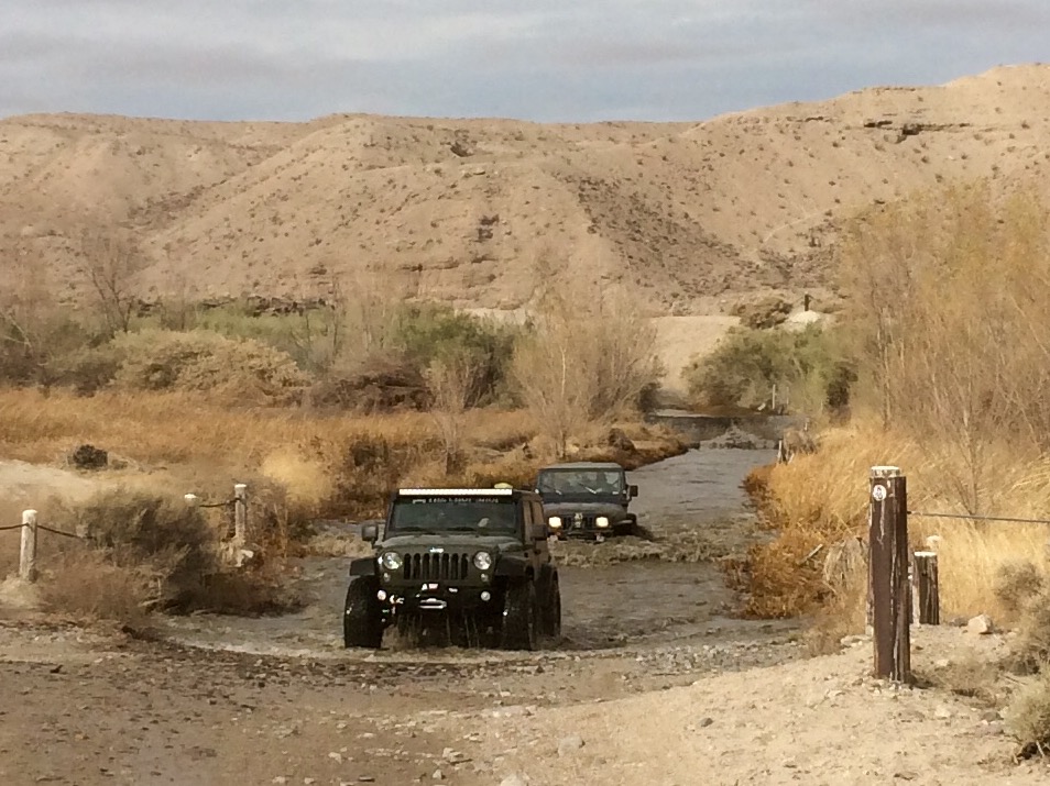
Less than an hour into the trail we encountered the Mojave River crossing. I figured we would stop and check the water depth to see if we could make it through. Instead, Kevin, who is leading the caravan just charges straight through so we follow right behind. The water seemed like it was going to swallow our car, but it was too late to stop. Our only choice was to power through to the other side.
After the river crossing we stopped at an old bridge with train tracks. I assumed it was no longer in use but as soon as I climbed the bridge for an aerial photo a train came roaring by a few feet from me. The conductor sounded pretty angry as he honked his horn, but I’m surely not the first idiot to pull that stunt.
“don’t touch it, it might be a crime scene”
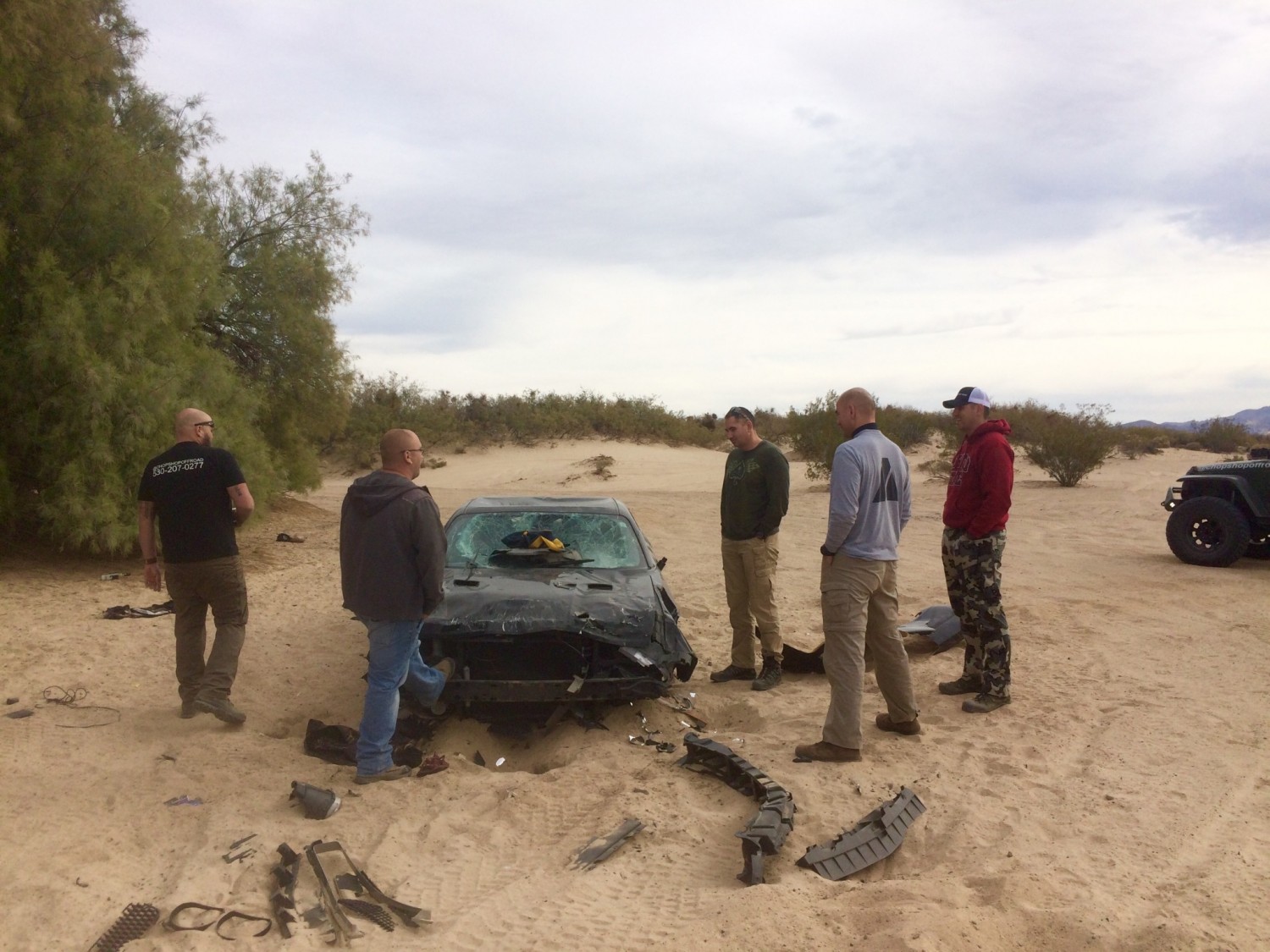
We continued on until we came across a relatively new abandoned Challenger in the middle of the desert. It looked like a crime scene but after finding no dead bodies in the backseat, we came to the conclusion that some teenagers were probably just having fun riding their trucks over a broken down car. I was reminded of my Prius I left at the truck stop and figured it probably looked a lot like the challenger by now. “You got nothing to worry about,” Sesar says laughing.
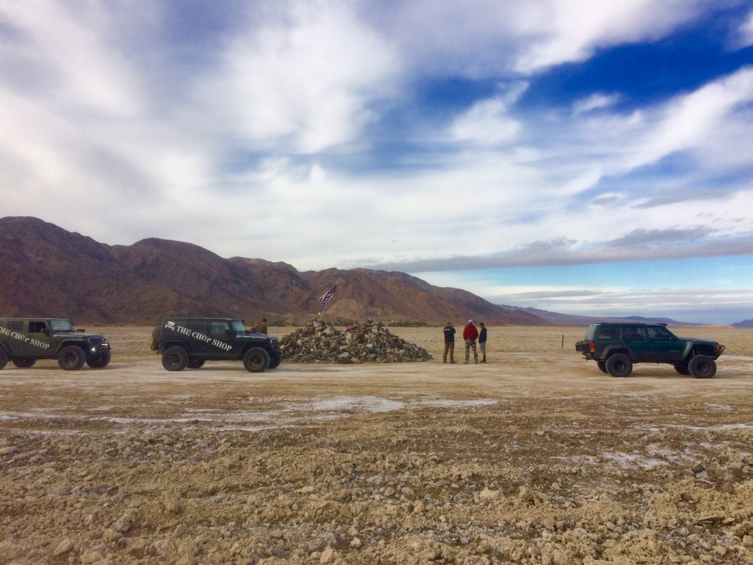
on this day, some very cool stuff went down…
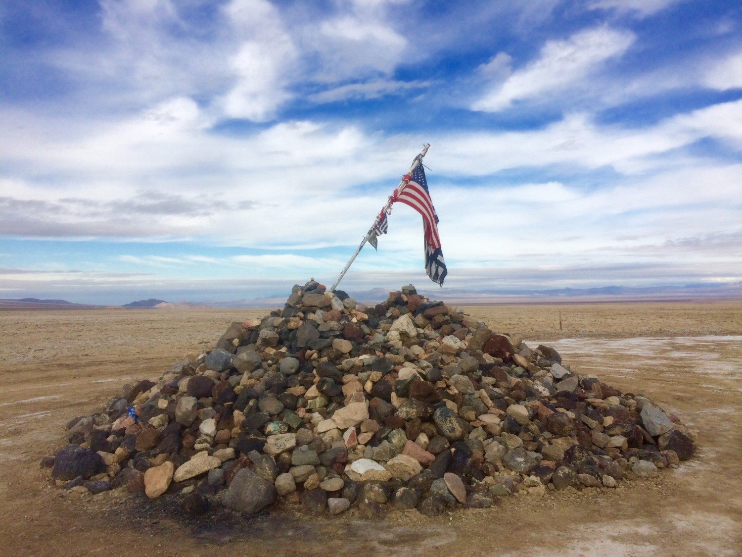
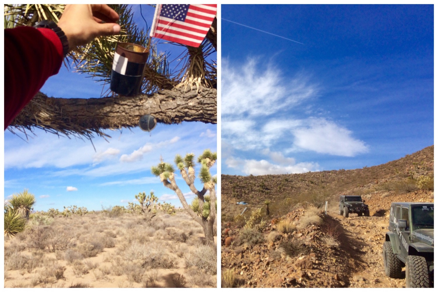
Travelers monument was our next stop on the trail. Everybody got out of their jeeps and threw a rock onto the pile for good luck. There is a secret plaque on top of the rock pile, and tradition dictates that only those that travel the Mojave trail get to read it. The profound message can be life changing.
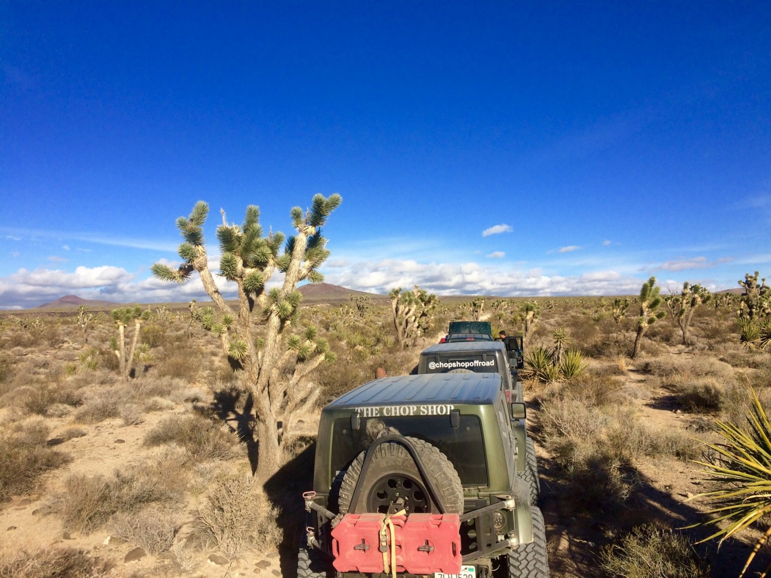
Eventually we reached a beautiful forest of Joshua trees. Apparently, the area is protected for a rare species of gnomes and frogs. When Sesar told me to bring a small porcelain gnome and frog, I assumed it was an inside joke. Sure enough, everybody else brought items to contribute to the growing population of porcelain figurines. I still don’t know why.
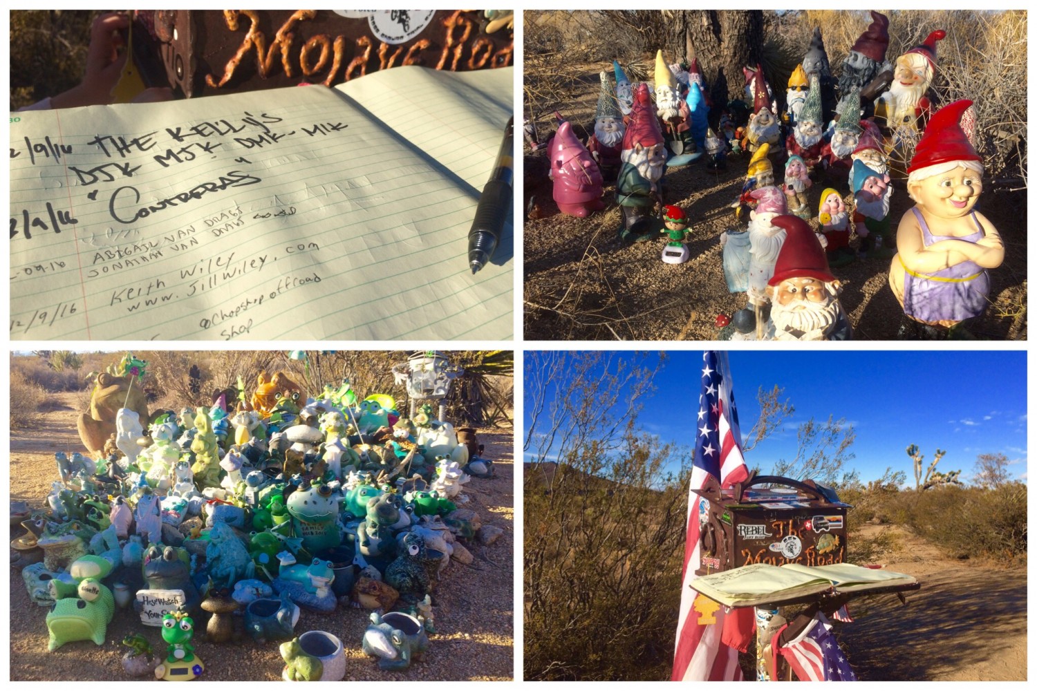
Afterwards, we signed the log book and continued on our journey. We eventually found a nice campsite near the base of a mountain before sunset. Sesar offered to let me try his Eno hammock he had been raving about. I was plenty comfortable on my cot the night before but I obliged and he took my cot. I woke up freezing in the middle of the night just waiting for the night to be over. Morning finally came and Sesar boasted he was so warm on the cot that he was nearly sweating. Army guys get a kick out of pranking city boys.
“we just hit 80!”
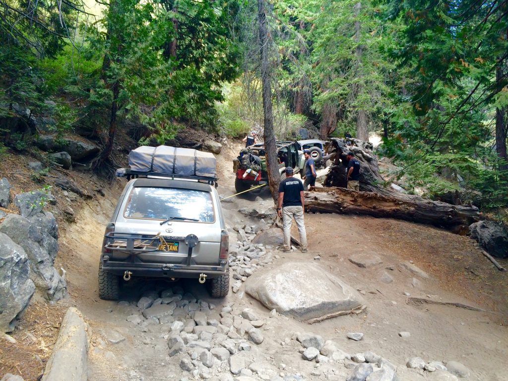
The next day three more vehicles joined us on the trail bringing our caravan to eight jeeps and trucks. This gave us new blood to banter about shocks and coils with and tell our lies to. It wouldn’t be a jeep trip without at least one mishap, but we managed to put out an electrical fire with some quick thinking (not water!). Afterwards, we paid the toll to the penny can hanging from the tree and continued on the last straightaway at top speeds. “We just hit 80!” someone called out over the radio.
We reached Laughlin before sundown and celebrated with a huge buffet and more jeep banter. The moment of truth came the next morning when we pulled into the truck stop in Barstow. My Prius was right there where I left it without a scratch. I guess maybe truckers do have a sense of humor.
by Keith Wiley | Oct 5, 2016 | Adventure
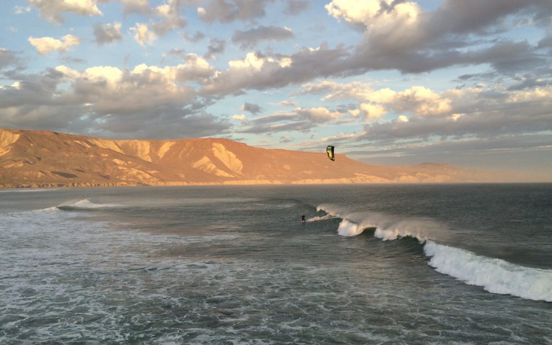
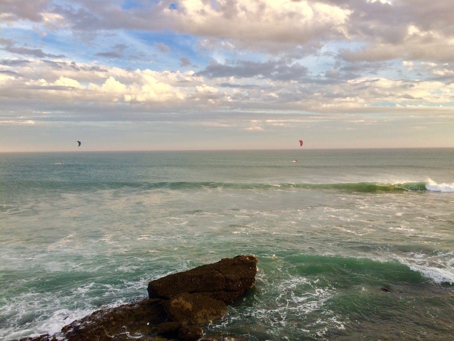
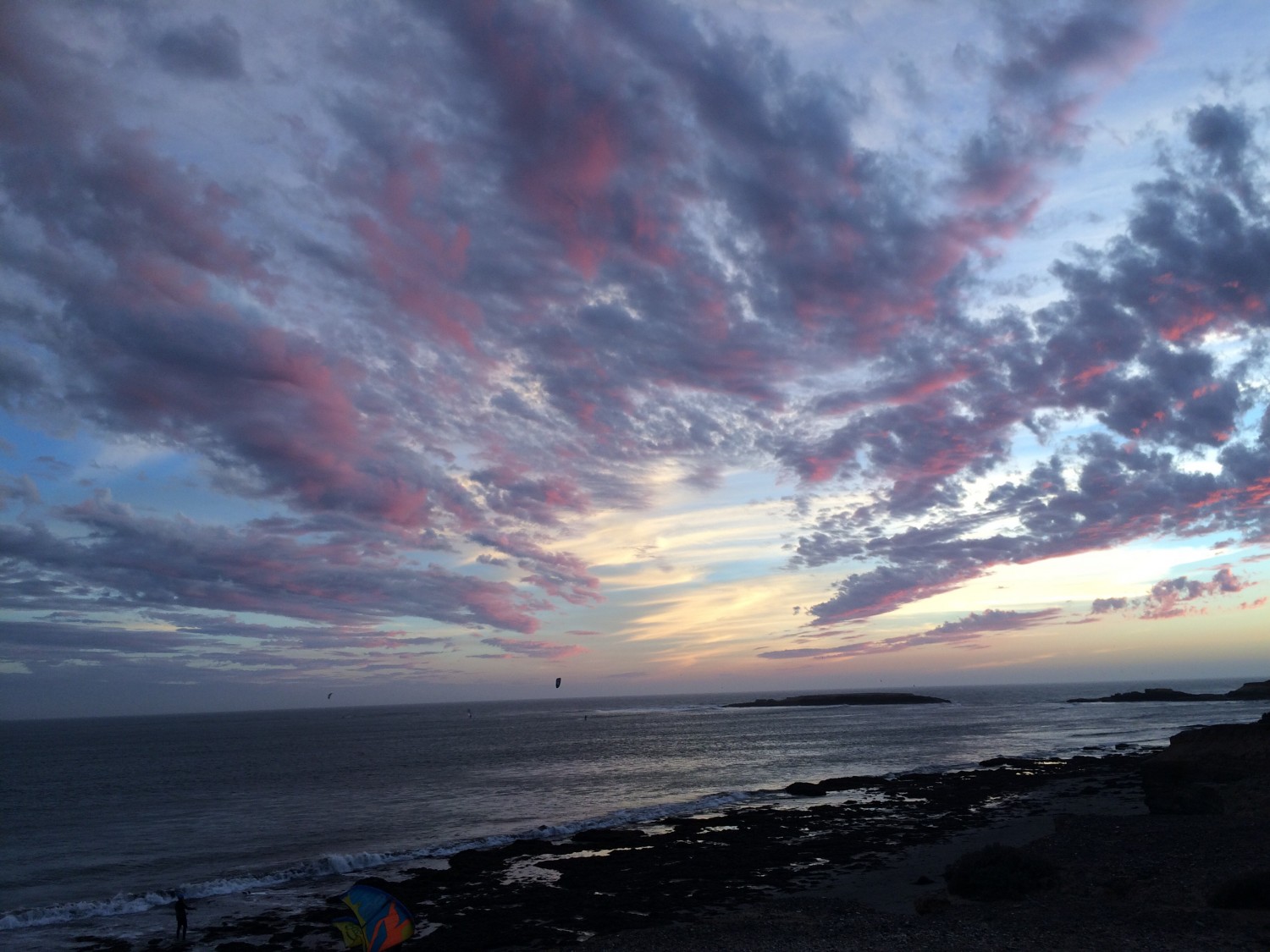
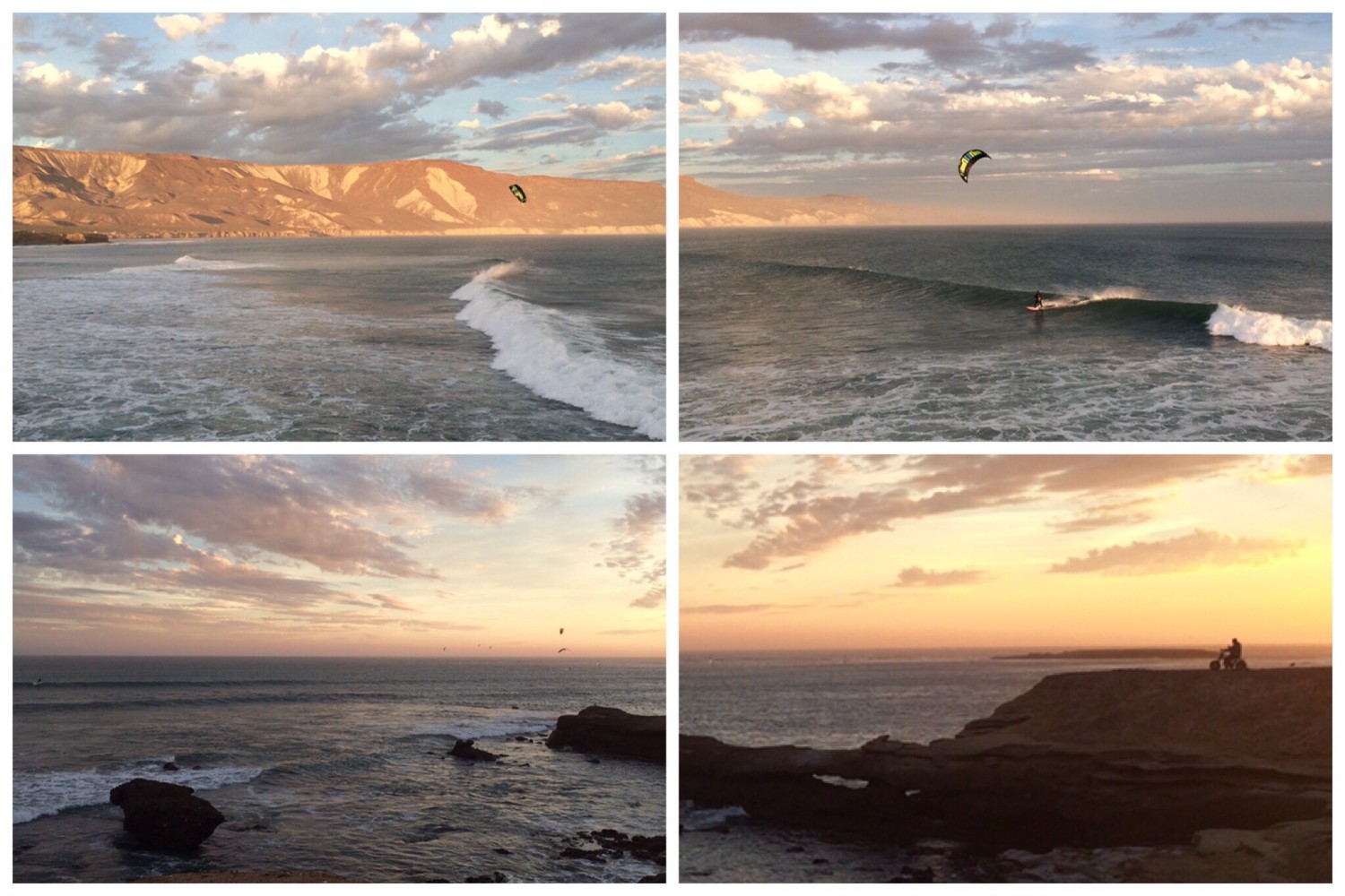
A camping and kitesurfing adventure in Punta San Carlos
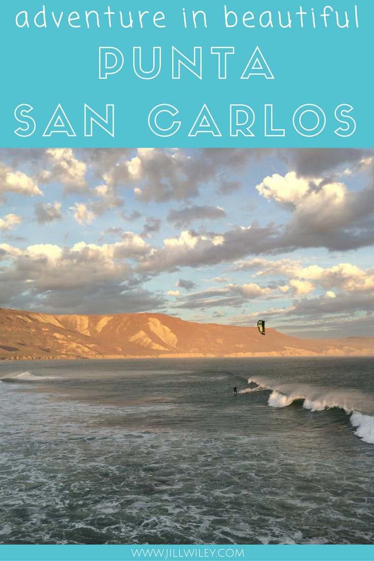
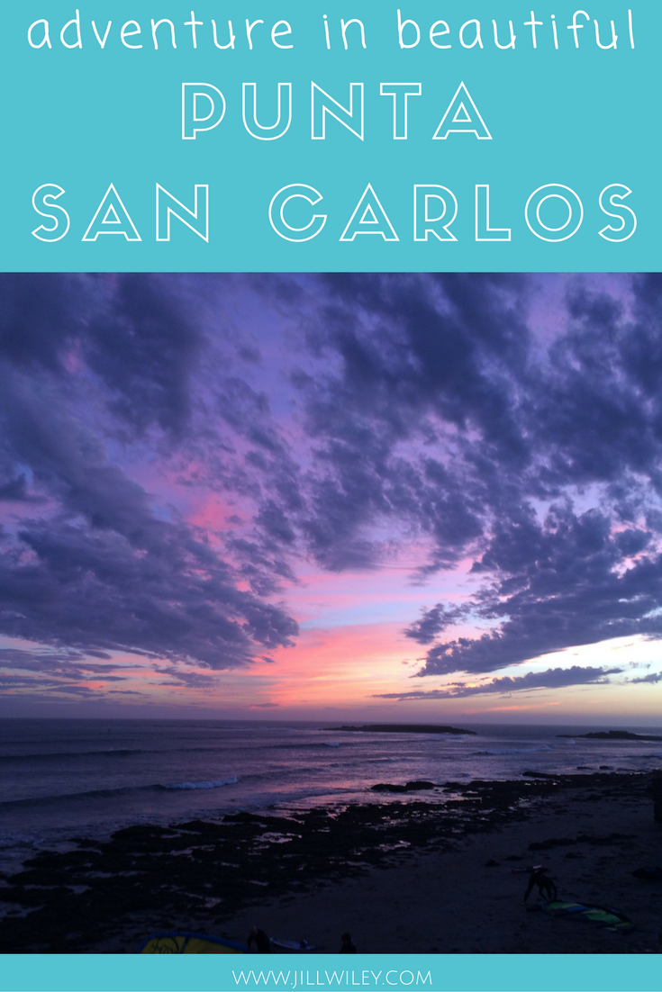
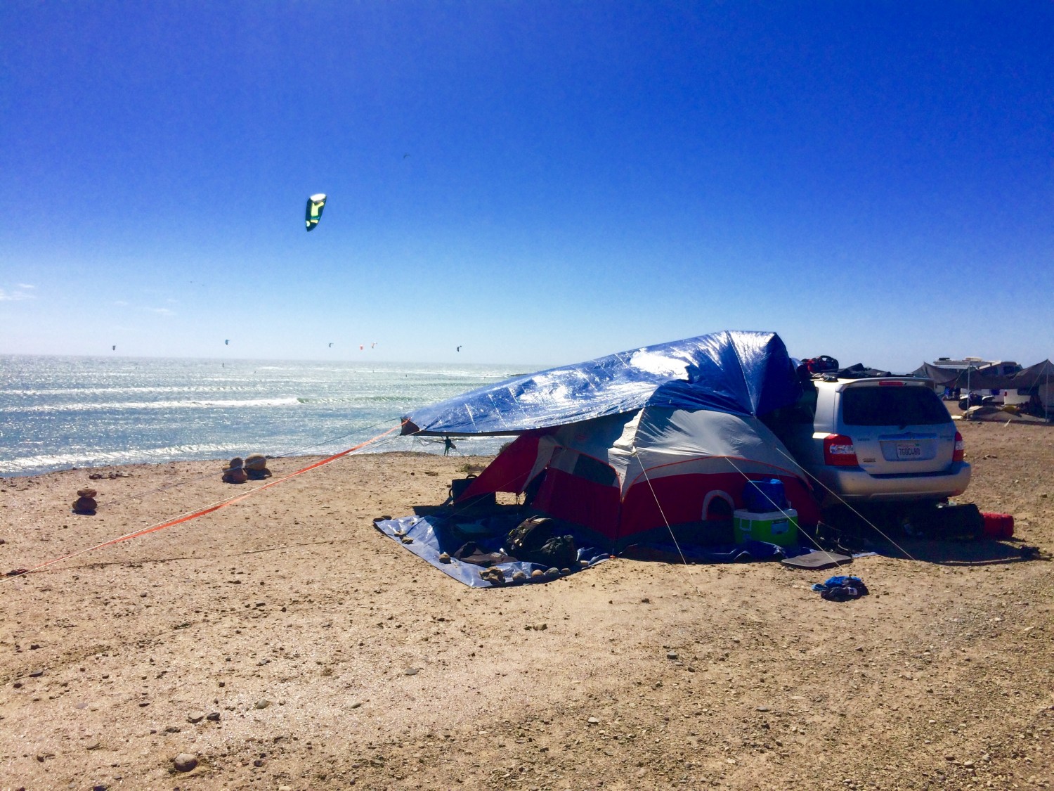
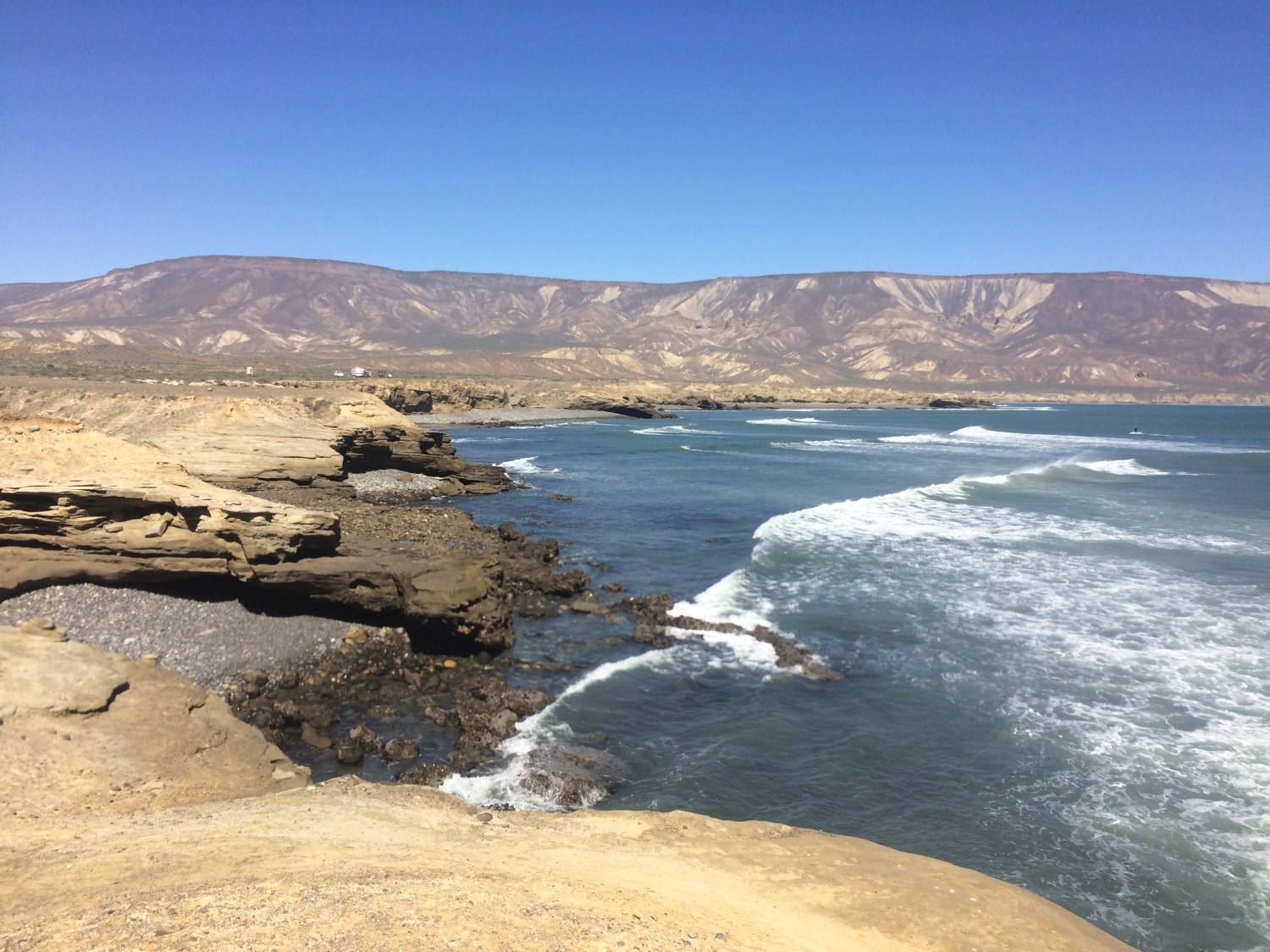
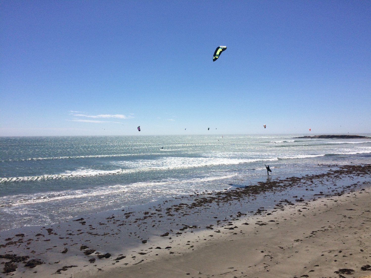
Phenomenal sunsets! Incredible coastline! Punta San Carlos in Baja Mexico is gorgeous. It’s also a Mecca for outdoor adventure in the form of camping, mountain biking, surfing, kiteboarding, and paddle boarding. However, it’s definitely no luxury beachfront hotel resort with plush rooms and drinks at the swim-up pool bar.
A trip to Punta San Carlos involves driving eight hours south of the border in Baja Mexico. The last two hours are across 60km of a very rocky dirt road. When you arrive, you will need to set up a tent on an exposed windy and sunny cliff unless you have an RV. Either way, you have to truly love extreme sports to end up camping in Punta San Carlos.
You will be about three hours from any food, water and supplies so pack wisely. A hat, sunscreen, and deep blue rub were essential for this trip, among other things. You’ll also need to find a way to create some shade in this beautiful barren oceanfront desert cliff. Our jenky tarp set-up helped a little but was no match for the 25mph wind by the third day. We plan to improve our camping game next year with some fence posts to tie our shade to. We also want a Yetti cooler so the ice lasts longer than a few days.
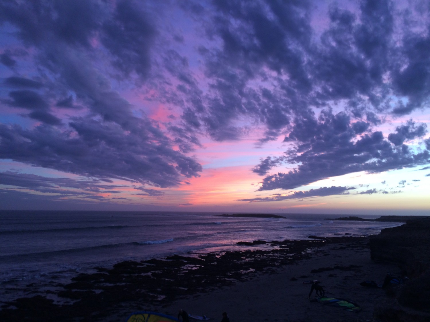
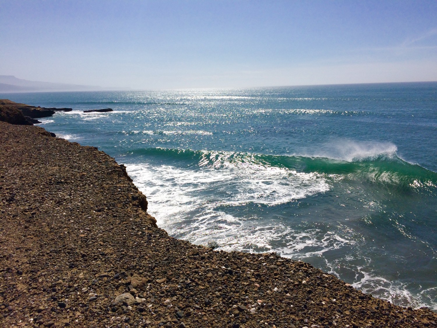
Despite its proximity, it’s a different world from San Diego, though no less beautiful. Its a destination that can be ranked along with Fiji and Mauritius for perfect kitesurfing wave conditions. Summer is the best time to catch a perfect south swell with a side-offshore wind. It also has incredible mountain biking trails and stunning sunsets with ALL of the colors!
Perhaps the best part is that it’s almost free!
Gas and food were our only real costs. We devoured carne asada steaks and tacos cooked on our camping stove after two days of kitesurfing. We also enjoyed a few bottles of wine while we gazed at the amazing sky above the remote seaside cliff.
However, unless you are ready to embark on a serious off-road and extreme sport adventure in Baja Mexico, just enjoy these beautiful pictures that take you away to a better place.
Although, if you decide you have to go there but you don’t want to rough it, check out Solosports. For about $2700, they will fly you in directly from San Diego on a tiny plane for a week stay. They provide a tent camp, three cooked meals, private showers, internet access, a bar, lessons and gear for watersports and mountain biking.
by Keith Wiley | Sep 9, 2016 | Adventure
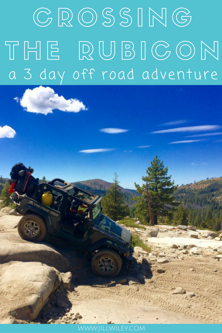
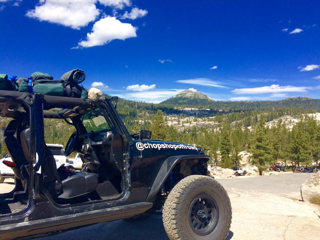
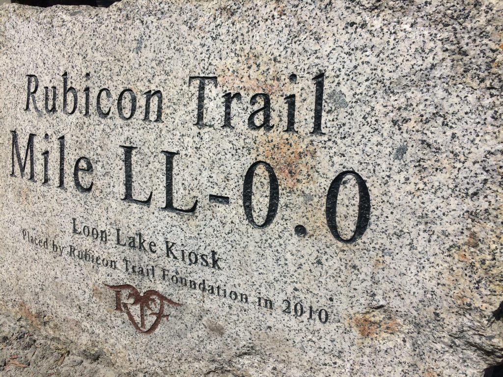
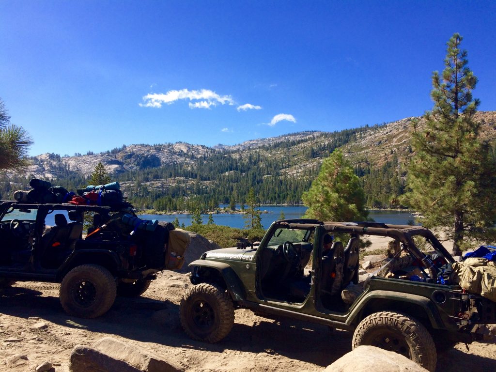
The Rubicon Trail is the Mecca of off-roading jeep adventures in North America. It sets the bar for which all other trails are judged by, not only for its difficulty but for its beauty. While the entire trail is only about 22 miles long and only about 10 of it are off-road, it runs through some of the most beautiful mountains and lakes in the country, finishing at Lake Tahoe.
With the right vehicle and crew, the trail can be completed in one day. However, it is far more fun to take the 3 day leisurely route. This allows for many stops to enjoy the views, swim in the lakes, have a drink at the “beer tree,” watch other jeeps attempt difficult maneuvers, and cook and sleep by a campfire in the great outdoors.
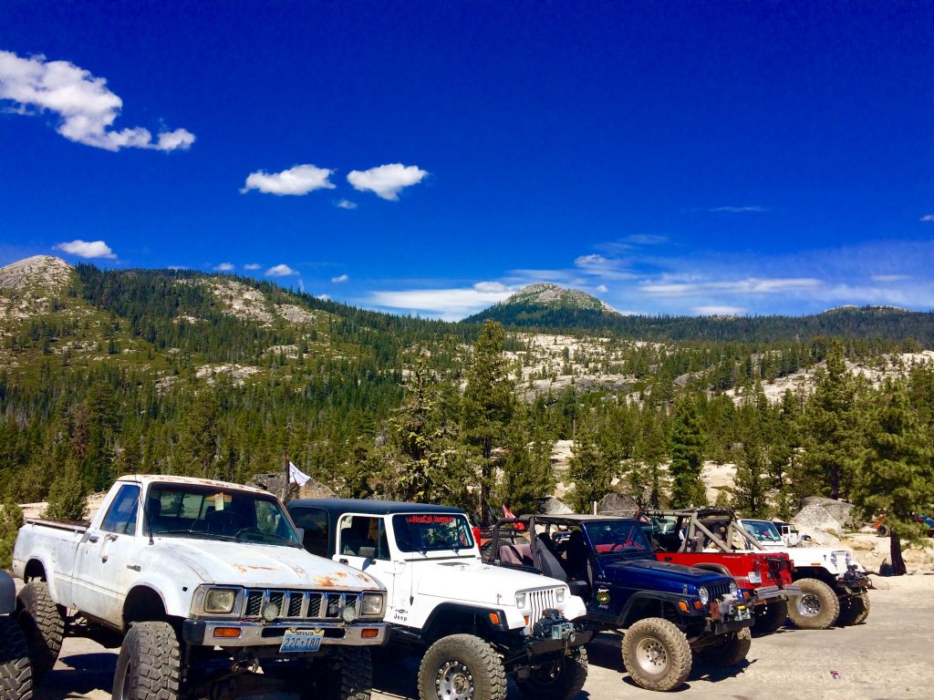
You don’t want to attempt this trail unprepared. A responsible attempt requires a high performance off-road vehicle with over $10k in after-market parts to lift the clearance and reinforce the entire bottom of the vehicle with steel plates to protect it as it slides over boulders. Fortunately we came prepared.
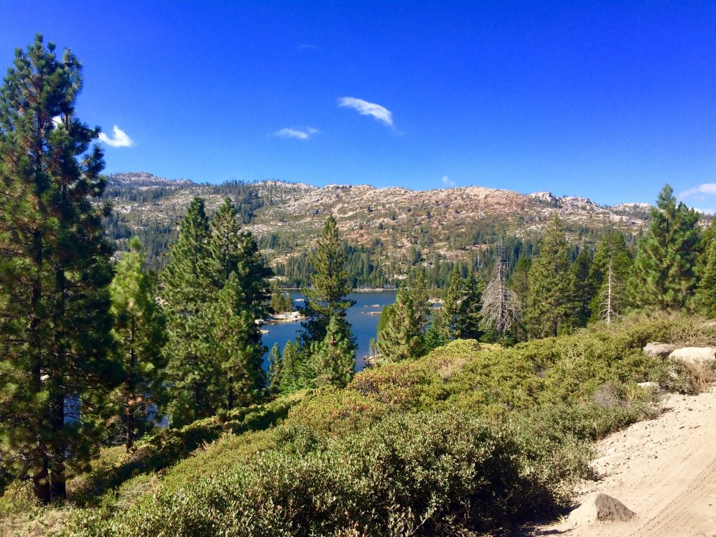
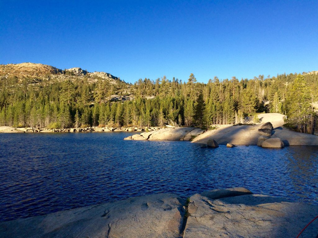
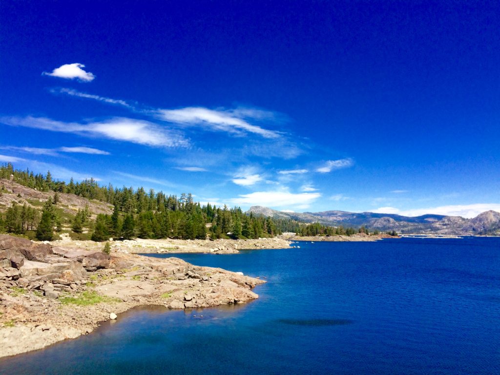
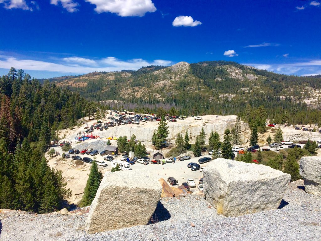
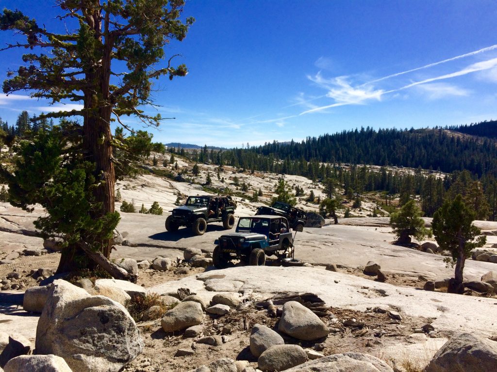
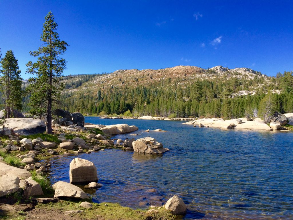
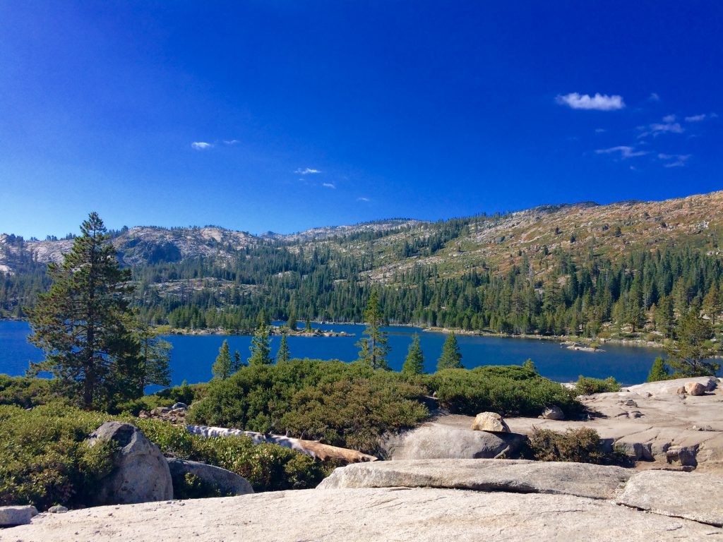
The off-road section of the trail begins at Loon Lake, a stunning lake with surprisingly clear blue water, not your typical brownish-green dirty looking lake. We drive past Loon Lake in awe, and the excitement really begins to kick in as we peer over our other shoulder down a steep hill to where hundreds of jeeps have gathered for a Labor Day jamboree called the Cantina on the Con near the beginning of the trail.
We stop briefly to air down our tires from 30 to 10 psi to gain maximum traction for the daunting trail. As we are airing down, a large truck that looks like it has been crushed by a wrecking ball crawls past us going the opposite direction towards home. We gawk at the shattered front windshield and twisted truck body and frame. Our excitement gets an adrenaline boost as our mind begins to process the potential danger we are embarking upon.
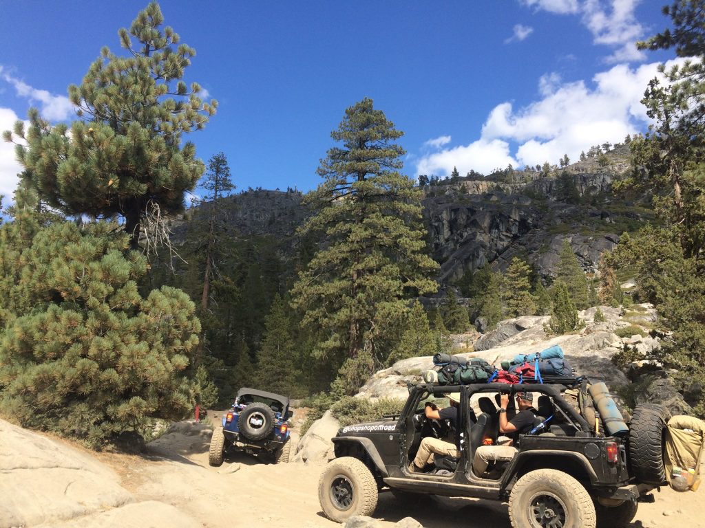
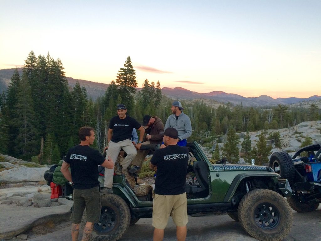
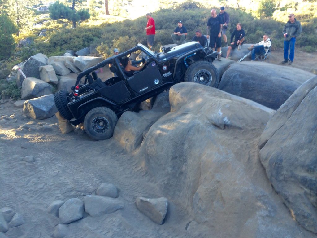
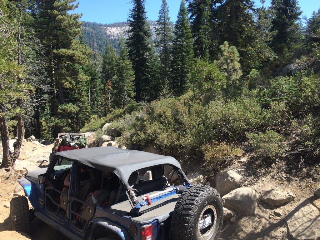
Sesar, our crew leader is an army veteran officer who owns a jeep shop called “The Chop Shop” and has about twenty years of experience off-roading. We know we are in good hands, but I still have to ask him – “What’s our chance of rolling the jeep on this trip?” “About 30%” he responds. With that, we buckle up and begin climbing across the first few boulders on the trail.
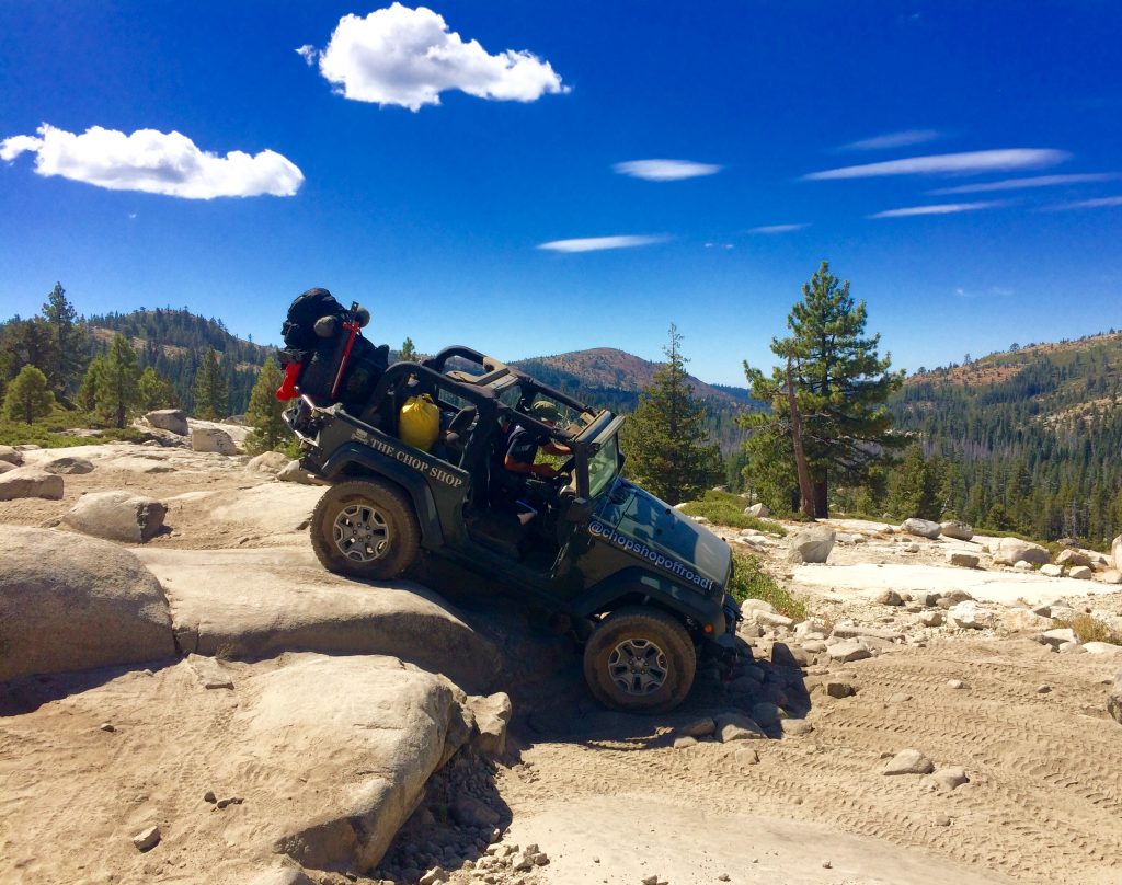
The trail starts off pretty intense. The first section is very narrow with lots of boulders and trees seemingly coming at you from every direction. I have no idea how far the jeep can lean before tipping over, so I grab on to the frame of the truck to brace myself, but Sesar warns me that my hands will get crushed if we roll the jeep. He instructs me how to cross my arms and lean toward the center in the event we roll. I comply but still wonder what will protect me from getting impaled by a protruding rock or branch when we roll. “Just don’t roll” I say. After a few minutes of rocking and climbing over the boulders at 0-3mph, the fear turns to excitement again. This is surprisingly fun! I now understand why Sesar does what he does.
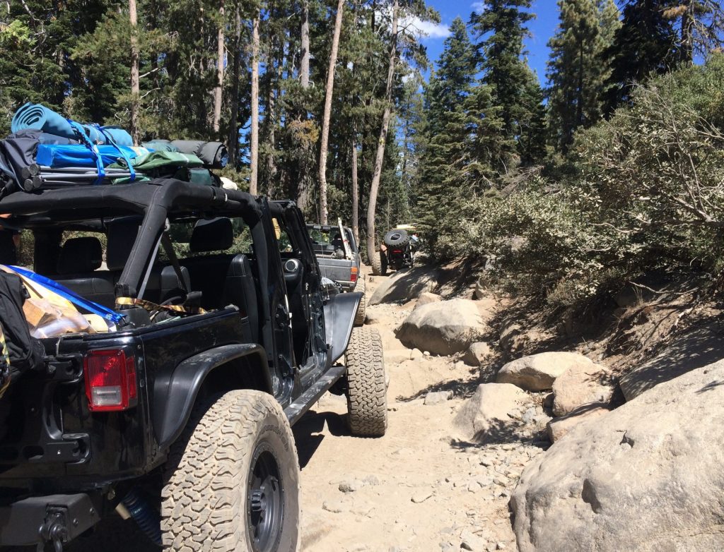
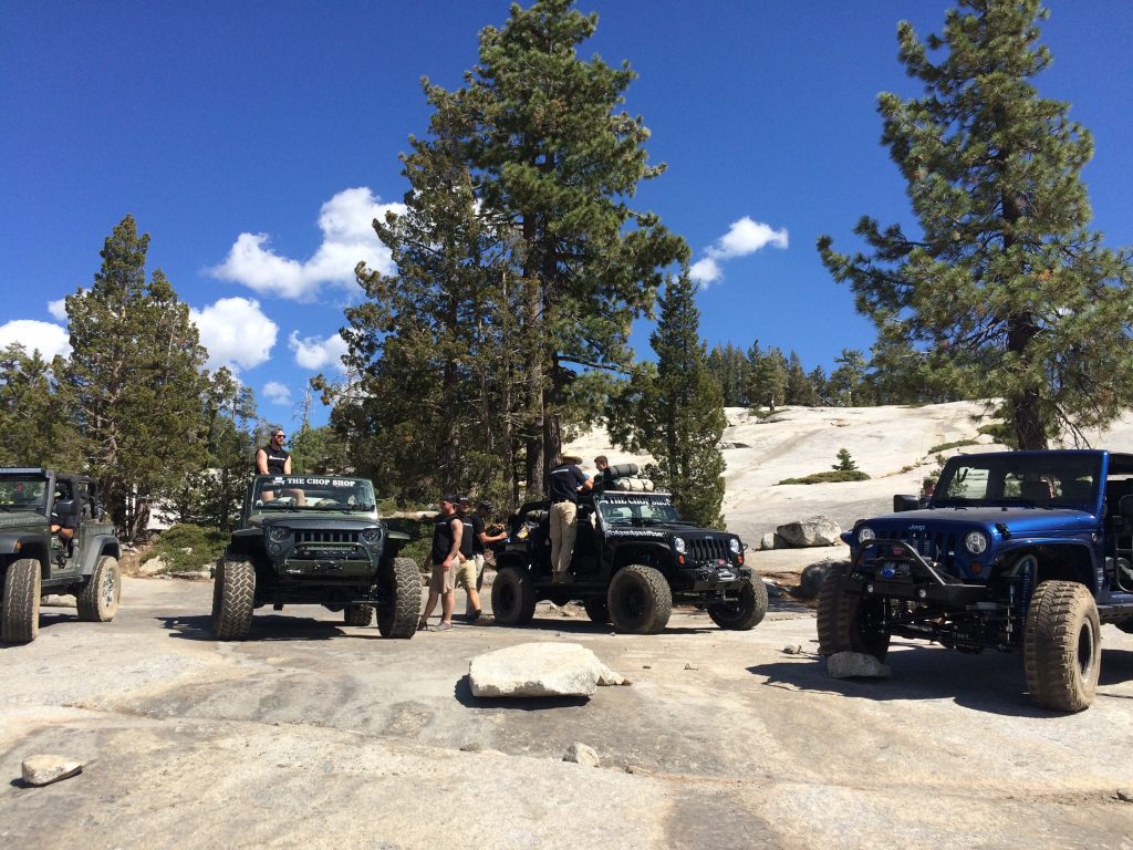
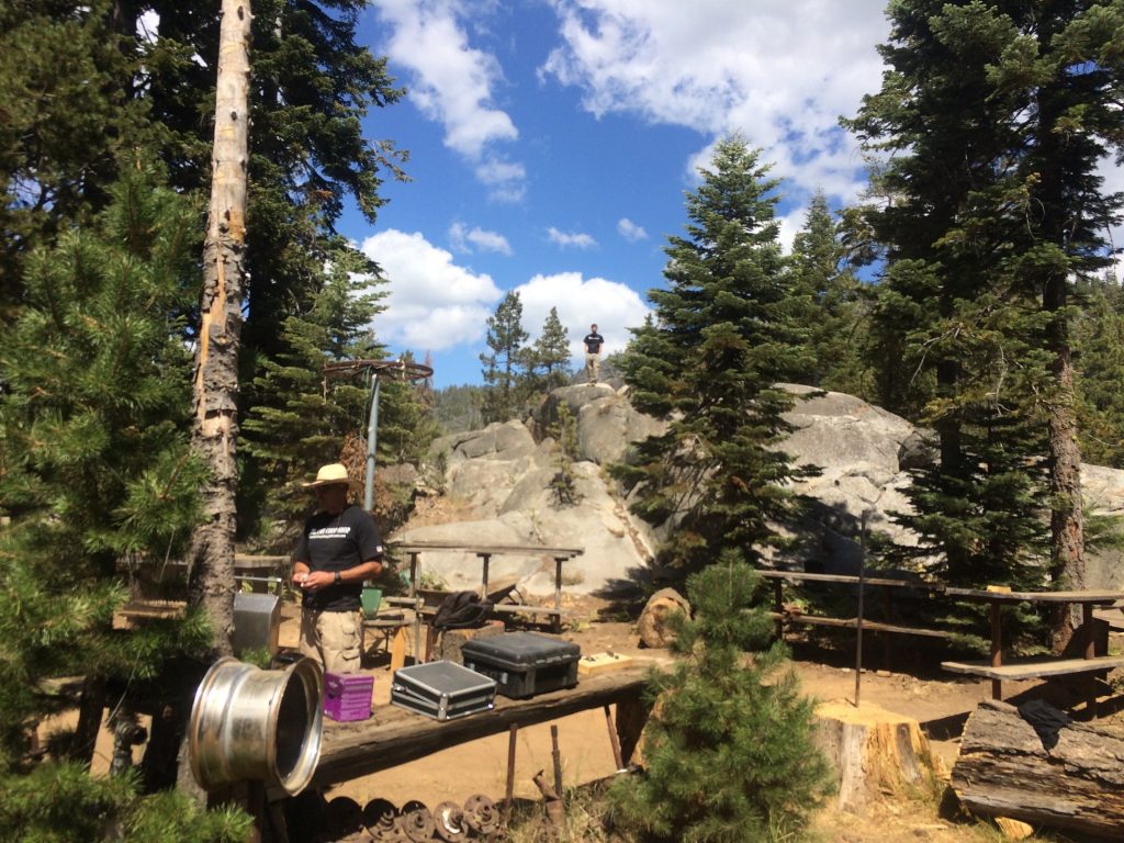
We complete the first section of the trail and stop for a refreshment near the “beer tree,” on a huge granite slab called the granite bowl. We can see for miles in every direction as we toast to our adventure and soak in the incredible views. There are 13 of us in four jeeps, all four of which have been given the full Chop Shop upgrade.
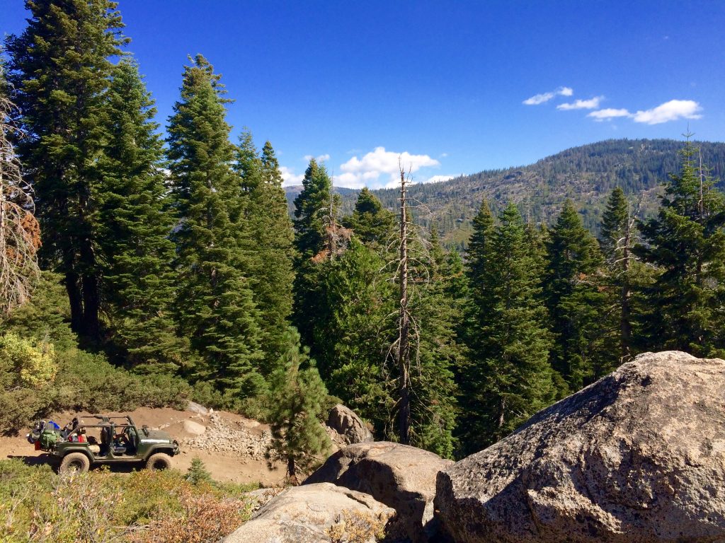
After a refreshing break we load up and continue on to the Soup Bowl, a big boulder pile that regularly attracts crowds of weekend warriors looking to test their vehicle’s mettle. We continue on the trail for the rest of the day, stopping every 30 minutes or so to soak in the views, swap stories, and get to know each other better. We are all friends or family of Sesar, but we don’t all know each other before this trip.
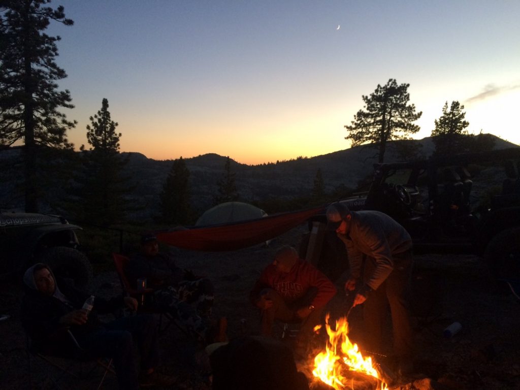
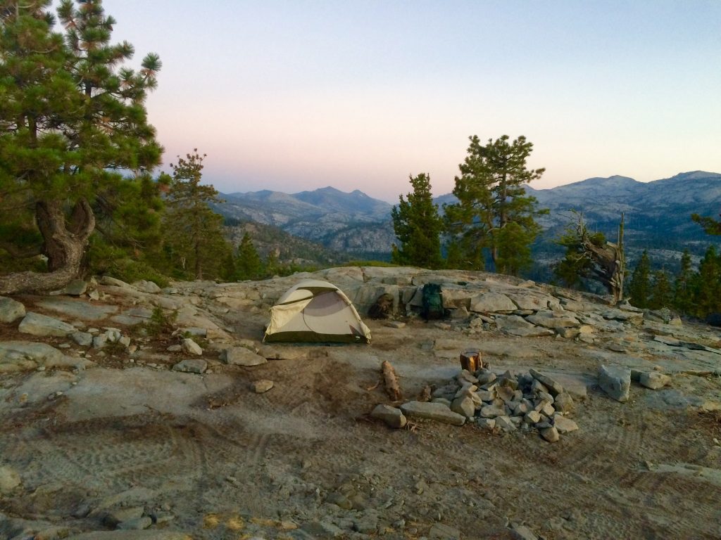
As night falls, we drive in using our headlights to Buck Lake, our chosen campsite for the first night. We devour our first meal since breakfast by a campfire with plenty of wine and Crown Royale. However, it’s not until sunrise the next morning that we can fully appreciate the prime location of the rock slab we slept on for the night.
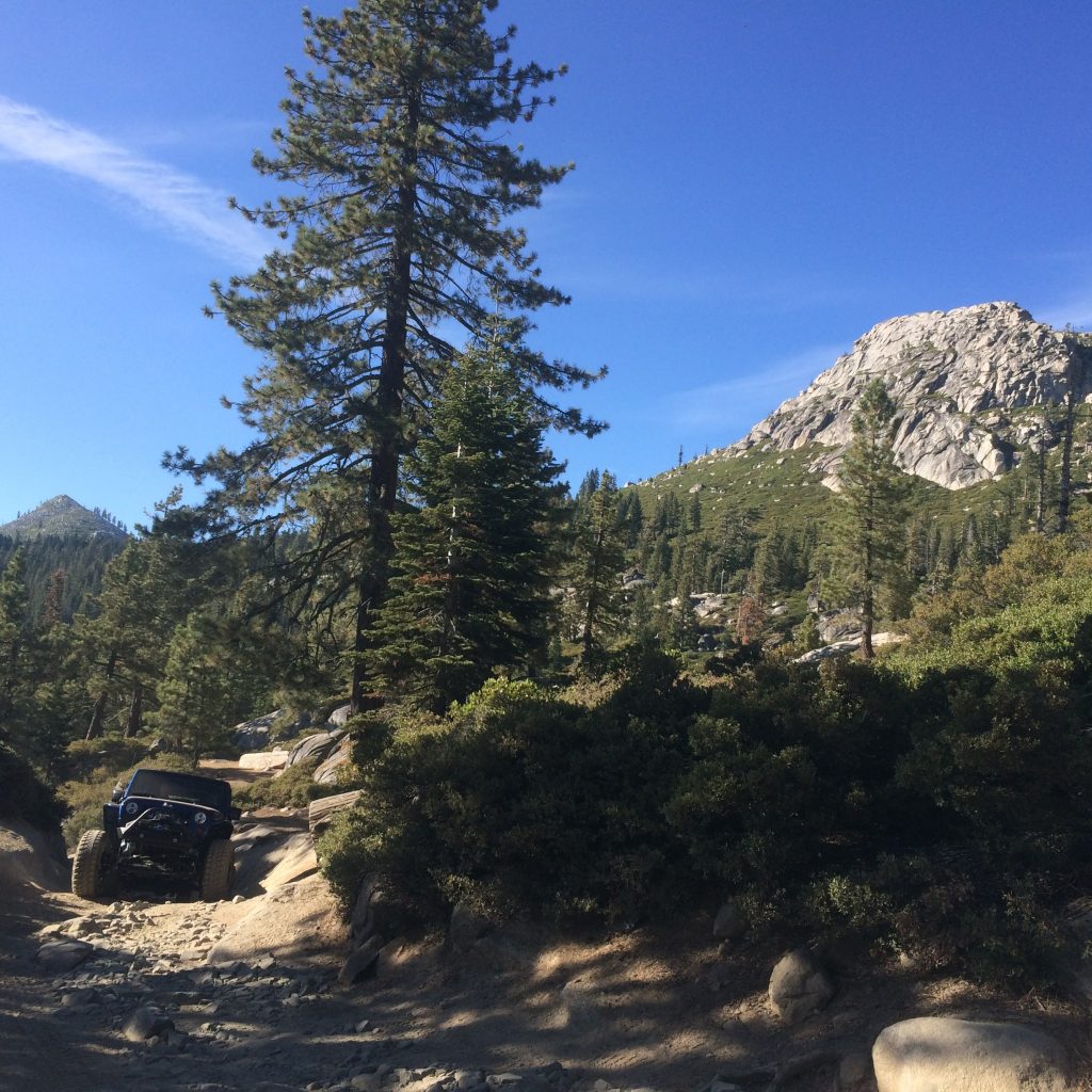
After coffee and breakfast, a few brave souls take a dip in the cold lake before we pack up and begin the next leg of the trip. It is here that Sesar passes the wheel over to me for my first real off-road driving experience. I am hesitant to drive at first because it looks like a stressful job. Kicking back and letting Sesar and his brother do all the driving had suited me just fine. However, within minutes of bouncing over a few boulders I’m having the time of my life. The Jeep is extremely user friendly and capable of handling the terrain.
He guides me from the ground with hand signals over boulders and between trees, all the while I’m watching his signals as much as I’m watching the road. My leg shakes a bit as I hold the brakes down as hard as I can while the jeep crawls down a steep 2-3 foot drop-off using downhill assist (cool technology). At this point, I’m more worried about his $70k jeep that I’m scraping against the boulders than I am about injuring myself. I have no idea how long I’m driving, but eventually we reach “Big Sluice,” a more difficult section of the trail, and Sesar decides it’s time for him to take over. At this point, I’m pretty content to hand over the wheel unscathed.
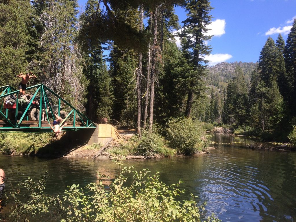
We continue our journey, stopping briefly for a few of our crew to backflip off the Rubicon River Bridge into a 3 foot deep stream, resulting in the only Injury of the trip (only a flesh wound). We then barbecue some carne Asada at Rubicon Springs before beginning the treacherous “Cadillac hill,” a steep 1-2 mile rocky incline with many cutbacks (not a good place to roll the jeep).
As if Cadillac Hill isn’t hard enough on its own, we spend two hours towing a stranded Land Cruiser up the hill. Their rear driveline was broken, a common occurrence for anyone attempting the trail without reinforcing the underside with steel protection. We knock on wood, grateful that we have made it this far without any problems.
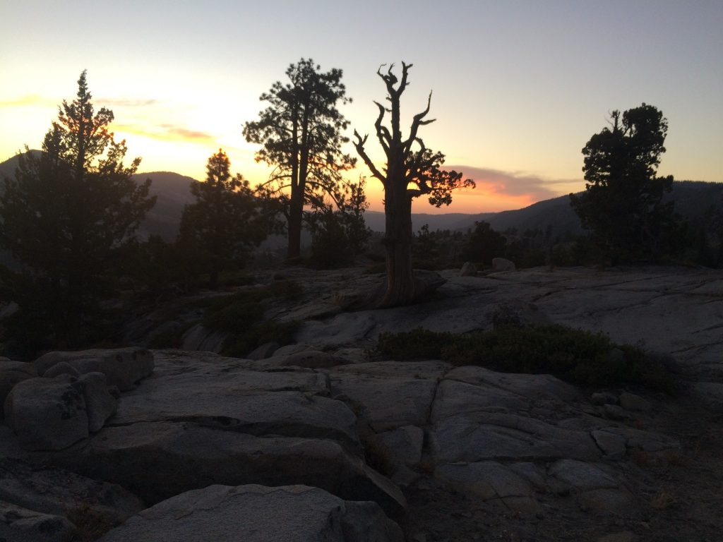
Eventually, we make it to Observation Point at the top of Cadilllac Hill in time for a beautiful sunset and a meal cooked over an open flame. The next morning we complete the last 1.5 hours of the trail which leaves us at Lake Tahoe where we all high-5 and begin the drive home. While I’m not ready to buy a $70k jeep, I am excited to crash his annual jeep adventure next year: the Moab in Utah!